Puerto Iguazú (Puerto Iguazú)
Puerto Iguazú is a border city in the province of Misiones, Argentina. With a population of 82,227 , it is the fourth largest city in the Province, after Posadas, Oberá, and Eldorado.
The world-renowned Iguazú Falls are only 18 km away from the city, and as a result the city has developed much of its infrastructure around tourism.
Spanish explorer Álvar Núñez Cabeza de Vaca became, in 1542, the first European to discover what are now called Iguazú Falls. He was drawn by the noise of the water, which can be heard at a distance of several kilometers. When the Spanish arrived in the 16th century, the Guaraní people were the principal inhabitants of the area.
Despite its early exploration, the area remained occupied only by the Guaraní Indians until 1880. Corrientes Province, which at that time included what is now Misiones, sold 50 square leagues (13000 km2) at the current site of Puerto Iguazú near the falls in 1881. The land changed hands three times in the course of just two years, and ended up as the property of Gregorio Lezama. At that time Misiones separated from Corrientes. Lezama funded a scientific expedition to explore the territory, enlisting Carlos Bosetti and Jordan Hummel for that purpose. Those two explorers later organized the first tourist trip to the falls; Lezama sold the land in 1888 to Martín Errecaborde and Company.
Territorial Governor Rudecindo Roca established Iguazú Department, one of 5 initial subdivisions in Misiones, in 1882. A Justice of the Peace, Alberto Mujica, was assigned to the area in 1897. The firm of Gibaja y Núñez opened the town's first hotel at this time to serve the growing numbers of tourists visiting Iguazú Falls. One of these, Victoria Aguirre, funded the first road into the town in 1901 as well as other civic improvements, and it was in her honor that on September 10, 1902, the settlement was formally established as Puerto Aguirre. A police department (1913), a civil registrar (1916), and a post office (1928) followed.
The Iguazú National Park was established as such by the national government in 1934, and in 1943 the town was renamed Puerto Iguazú. The Tancredo Neves Bridge, connecting the city with neighboring Foz do Iguaçu (Brazil), was opened in 1985.
Map - Puerto Iguazú (Puerto Iguazú)
Map
Country - Argentina
 |
 |
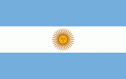
| Flag of Argentina | |
The earliest recorded human presence in modern-day Argentina dates back to the Paleolithic period. The Inca Empire expanded to the northwest of the country in Pre-Columbian times. The country has its roots in Spanish colonization of the region during the 16th century. Argentina rose as the successor state of the Viceroyalty of the Río de la Plata, a Spanish overseas viceroyalty founded in 1776. The declaration and fight for independence (1810–1818) was followed by an extended civil war that lasted until 1861, culminating in the country's reorganization as a federation. The country thereafter enjoyed relative peace and stability, with several waves of European immigration, mainly Italians and Spaniards, radically reshaping its cultural and demographic outlook; over 60% of the population has full or partial Italian ancestry, and Argentine culture has significant connections to Italian culture.
Currency / Language
| ISO | Currency | Symbol | Significant figures |
|---|---|---|---|
| ARS | Argentine peso | $ | 2 |
| ISO | Language |
|---|---|
| EN | English language |
| FR | French language |
| DE | German language |
| GN | Guarani language |
| IT | Italian language |
| ES | Spanish language |


