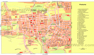
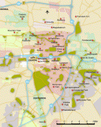
Pretoria
 |
 |
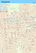
Pretoria straddles the Apies River and extends eastward into the foothills of the Magaliesberg mountains. It has a reputation as an academic city and center of research, being home to the Tshwane University of Technology (TUT), the University of Pretoria (UP), the University of South Africa (UNISA), the Council for Scientific and Industrial Research (CSIR), and the Human Sciences Research Council. It also hosts the National Research Foundation and the South African Bureau of Standards. Pretoria was one of the host cities of the 2010 FIFA World Cup.
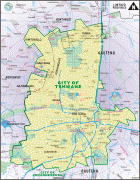
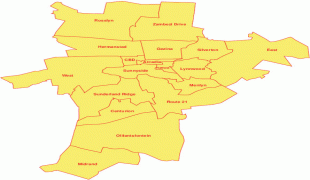
Pretoria is the central part of the City of Tshwane Metropolitan Municipality which was formed by the amalgamation of several former local authorities, including Bronkhorstspruit, Centurion, Cullinan, Hammanskraal and Soshanguve. Some have proposed changing the official name from Pretoria to Tshwane, which has caused some public controversy.
Pretoria is named after the Voortrekker leader Andries Pretorius, and South Africans sometimes call it the "Jacaranda City", because of the thousands of jacaranda trees planted along its streets and in its parks and gardens.
Pretoria was founded in 1855 by Marthinus Pretorius, a leader of the Voortrekkers, who named it after his father Andries Pretorius and chose a spot on the banks of the Apies rivier (Afrikaans for "Monkeys river") to be the new capital of the South African Republic (Zuid Afrikaansche Republiek; ZAR). The elder Pretorius had become a national hero of the Voortrekkers after his victory over Dingane and the Zulus in the Battle of Blood River in 1838. The elder Pretorius also negotiated the Sand River Convention (1852), in which the United Kingdom acknowledged the independence of the Transvaal. It became the capital of the South African Republic on 1 May 1860.
The founding of Pretoria as the capital of the South African Republic can be seen as marking the end of the Boers' settlement movements of the Great Trek.
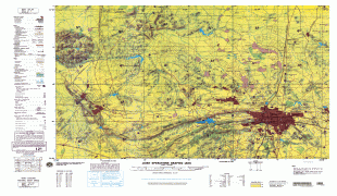
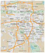
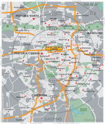
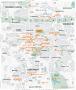
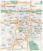
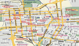
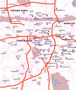
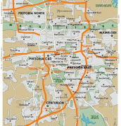
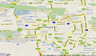
Map - Pretoria
Map


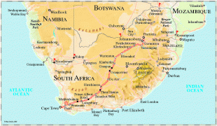


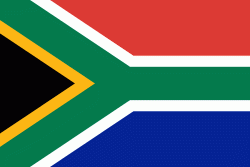
Country - South_Africa
 |
 |
| Flag of South Africa | |
About 80% of the population are Black South Africans. The remaining population consists of Africa's largest communities of European (White South Africans), Asian (Indian South Africans and Chinese South Africans), and multiracial (Coloured South Africans) ancestry. South Africa is a multiethnic society encompassing a wide variety of cultures, languages, and religions. Its pluralistic makeup is reflected in the constitution's recognition of 11 official languages, the fourth-highest number in the world. According to the 2011 census, the two most spoken first languages are Zulu (22.7%) and Xhosa (16.0%). The two next ones are of European origin: Afrikaans (13.5%) developed from Dutch and serves as the first language of most Coloured and White South Africans; English (9.6%) reflects the legacy of British colonialism and is commonly used in public and commercial life.
Currency / Language
| ISO | Currency | Symbol | Significant figures |
|---|---|---|---|
| ZAR | South African rand | Rs | 2 |
| ISO | Language |
|---|---|
| AF | Afrikaans language |
| EN | English language |
| ST | Sotho language |
| SS | Swati language |
| TS | Tsonga language |
| TN | Tswana language |
| VE | Venda language |
| XH | Xhosa language |
| ZU | Zulu language |