Prestea
Prestea is a town in the Western Region, in southwest Ghana and about 50 km north of the coast of the Atlantic Ocean. It lies on the west bank of the Ankobra River, about 60 mi (100 km) northwest of Cape coast. The town is part of the Prestea-Huni Valley District. Prestea is the forty-sixth most populous in Ghana, in terms of population, with a population of 35,760 people. A railway line used to connects with Prestea to Tarkwa and beyond to the coastal city of Sekondi-Takoradi.
Since 1873 there has been mining of gold deposits in Prestea, and in 1965, independent gold mining companies based in Prestea were merged at the time by the government. The World Bank granted a loan in 1985 to finance the gold mining in Prestea, but after three years of continuous losses by the merged gold company, the mines that were privatized from 1994 to 1999 had their mineral rights sold to the Canadian company of Golden Star Resources. The mining of gold caused environmental problems, such as the storage of overburden in the vicinity of the hospital, contamination of the river with toxic waste, as happened in October 2004. Due to the vibrations caused by the explosions, damage was caused to the buildings of the town. The gold mines are a tourist attraction, partly due to the smelter where the gold is melted down into ingots and two tennis courts and an 18-hole golf course.
Since 1873 there has been mining of gold deposits in Prestea, and in 1965, independent gold mining companies based in Prestea were merged at the time by the government. The World Bank granted a loan in 1985 to finance the gold mining in Prestea, but after three years of continuous losses by the merged gold company, the mines that were privatized from 1994 to 1999 had their mineral rights sold to the Canadian company of Golden Star Resources. The mining of gold caused environmental problems, such as the storage of overburden in the vicinity of the hospital, contamination of the river with toxic waste, as happened in October 2004. Due to the vibrations caused by the explosions, damage was caused to the buildings of the town. The gold mines are a tourist attraction, partly due to the smelter where the gold is melted down into ingots and two tennis courts and an 18-hole golf course.
Map - Prestea
Map
Country - Ghana
 |
 |
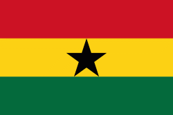
| Flag of Ghana | |
The Bono state existed in the area that is modern day Ghana during the 11th century. Kingdoms and empires such as Kingdom of Dagbon in the north and the Ashanti Empire in the south emerged over the centuries. Beginning in the 15th century, the Portuguese Empire, followed by other European powers, contested the area for trading rights, until the British ultimately established control of the coast by the 19th century. Following over a century of colonial resistance, the current borders of the country took shape, encompassing 4 separate British colonial territories: Gold Coast, Ashanti, the Northern Territories, and British Togoland. These were unified as an independent dominion within the Commonwealth of Nations. On 6th March 1957, Ghana became the first country in Sub-Saharan Africa to achieve sovereignty. Ghana subsequently became influential in decolonisation efforts and the Pan-African movement.
Currency / Language
| ISO | Currency | Symbol | Significant figures |
|---|---|---|---|
| GHS | Ghanaian cedi | ₵ | 2 |
| ISO | Language |
|---|---|
| AK | Akan language |
| EN | English language |
| EE | Ewe language |
| TW | Twi |


