Potaro-Siparuni (Potaro-Siparuni Region)
Potaro-Siparuni (Region 8) is a region of Guyana. Venezuela claims the majority of the Region located west of the Essequibo River as part of Guayana Esequiba.
It borders the region of Cuyuni-Mazaruni to the north, the regions of Upper Demerara-Berbice and East Berbice-Corentyne to the east, the region of Upper Takutu-Upper Essequibo to the south and Brazil to the west.
The main villages in the region are Campbelltown, Orinduik, Mahdia, Paramakatoi and Tumatumari.
The Government of Guyana has administered three official censuses since the 1980 administrative reforms, in 1980, 1991 and 2002. In 2012, the population of Potaro-Siparuni was recorded at 10,190 people. Official census records for the population of Potaro-Siparuni are as follows:
* 2012 : 10,190
* 2002 : 10,095
* 1991 : 5,616
* 1980 : 4,485
Map - Potaro-Siparuni (Potaro-Siparuni Region)
Map
Country - Guyana
 |
 |
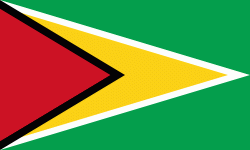
| Flag of Guyana | |
The region known as "the Guianas" consists of the large shield landmass north of the Amazon River and east of the Orinoco River known as the "land of many waters". Nine indigenous tribes reside in Guyana: the Wai Wai, Macushi, Patamona, Lokono, Kalina, Wapishana, Pemon, Akawaio and Warao. Historically dominated by the Lokono and Kalina tribes, Guyana was colonised by the Dutch before coming under British control in the late 18th century. It was governed as British Guiana, with a mostly plantation-style economy until the 1950s. It gained independence in 1966, and officially became a republic within the Commonwealth of Nations in 1970. The legacy of British rule is reflected in the country's political administration and diverse population, which includes Indian, African, Indigenous, Chinese, Portuguese, other European, and various multiracial groups. In 2017, 41% of the population of Guyana lived below the poverty line.
Currency / Language
| ISO | Currency | Symbol | Significant figures |
|---|---|---|---|
| GYD | Guyanese dollar | $ | 2 |
| ISO | Language |
|---|---|
| EN | English language |


