Map - Porto

Porto
Porto or Oporto is the second-largest city in Portugal, the capital of the Oporto District, and one of the Iberian Peninsula's major urban areas. Oporto city proper, which is the entire municipality of Porto, is small compared to its metropolitan area, with an estimated population of just 231,800 people in a municipality with only 41.42 km2. Porto's metropolitan area has around 1.7 million people (2021) in an area of 2395 km2, making it the second-largest urban area in Portugal. It is recognized as a global city with a Gamma + rating from the Globalization and World Cities Research Network.

Located along the Douro River estuary in northern Portugal, Oporto is one of the oldest European centres, and its core was proclaimed a World Heritage Site by UNESCO in 1996, as "Historic Centre of Porto, Luiz I Bridge and Monastery of Serra do Pilar". The historic area is also a National Monument of Portugal. The western part of its urban area extends to the coastline of the Atlantic Ocean. Its settlement dates back many centuries, when it was an outpost of the Roman Empire. Its combined Celtic-Latin name, Portus Cale, has been referred to as the origin of the name Portugal, based on transliteration and oral evolution from Latin. In Portuguese, the name of the city includes a definite article: o Porto ("the port" or "the harbor"), which is where its English name "Oporto" comes from.

Port wine, one of Portugal's most famous exports, is named after Porto, since the metropolitan area, and in particular the cellars of Vila Nova de Gaia, were responsible for the packaging, transport, and export of fortified wine. In 2014 and 2017, Oporto was elected The Best European Destination by the Best European Destinations Agency. Oporto is on the Portuguese Way path of the Camino de Santiago.
 
Map - Porto
Map
Google - Map - Porto
Google
Google Earth - Map - Porto
Google Earth
Nokia - Map - Porto
Nokia
Openstreetmap - Map - Porto
Openstreetmap
Map - Porto - Esri.WorldImagery
Esri.WorldImagery
Map - Porto - Esri.WorldStreetMap
Esri.WorldStreetMap
Map - Porto - OpenStreetMap.Mapnik
OpenStreetMap.Mapnik
Map - Porto - OpenStreetMap.HOT
OpenStreetMap.HOT
Map - Porto - OpenTopoMap
OpenTopoMap
Map - Porto - CartoDB.Positron
CartoDB.Positron
Map - Porto - CartoDB.Voyager
CartoDB.Voyager
Map - Porto - OpenMapSurfer.Roads
OpenMapSurfer.Roads
Map - Porto - Esri.WorldTopoMap
Esri.WorldTopoMap
Map - Porto - Stamen.TonerLite
Stamen.TonerLite
Country - Portugal
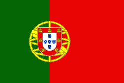
Flag of Portugal
Portugal, officially the Portuguese Republic (República Portuguesa ), is a country located on the Iberian Peninsula, in southwestern Europe, and whose territory also includes the Atlantic archipelagos of the Azores and Madeira. It features the westernmost point in continental Europe, and its Iberian portion is bordered to the west and south by the Atlantic Ocean and to the north and east by Spain, the sole country to have a land border with Portugal. Its two archipelagos form two autonomous regions with their own regional governments. Lisbon is the capital and largest city by population.

One of the oldest countries in Europe, its territory has been continuously settled, invaded and fought over since prehistoric times. The territory was first inhabited by pre-Roman and Celtic peoples who had contact with Phoenicians, ancient Greeks and Carthaginians. It was later ruled by the Romans, followed by the invasions of Germanic peoples and the Islamic invasion by the Moors, whose rule was eventually expelled during the Reconquista. Founded first as a county of the Kingdom of León in 868, gained its independence as the Kingdom of Portugal with the Treaty of Zamora in 1143.
Currency / Language  
ISO Currency Symbol Significant figures
EUR Euro € 2
ISO Language
PT Portuguese language
Neighbourhood - Country  
  •  Spain 
Administrative Subdivision
Country, State, Region,...