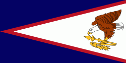
Poloa (Poloa)
Poloa is a village in American Samoa. It is located at the west side of Tutuila in the Alataua District. The village has 193 residents in 2010. The main denominations in the area are Methodist and Christian. Poloa has one elementary school. It is located in Lealataua County.
According to history, Since American culture was introduced, many Poloa villagers worked at shipyards of Germans and Americans.
Poloa is at the western terminus of American Samoa Highway 001. It is situated on a narrow coastal plain on Tutuila Island's western tip, nine miles west of Pago Pago. The village is made up of wood-frame homes and traditional fales. A school is located at the shoreline, approximately 700 ft. south of the village center. This elementary school has an enrollment of around 160 and also serves Poloa's neighboring villages. Due to the village's flatlands being ideal for development, the school was erected near the shore.
The name Poloa denotes that once the sun sets over the horizon, it will immediately become dark, or Po-loa. The name originated from a premodern account of the travels of the legendary twins Taema and Tilafaiga, in their search for Fututalie, a Samoan prince who lived in a village at Tutuila Island's western tip. A unique characteristic of this village they looked for was that the darkness descends as soon as the sun sets.
Map - Poloa (Poloa)
Map
Country - American_Samoa
 |
 |
American Samoa consists of five main islands and two coral atolls; the largest and most populous island is Tutuila, with the Manuʻa Islands, Rose Atoll and Swains Island also included in the territory. All islands except for Swains Island are part of the Samoan Islands, The total land area is 199 sqkm, slightly more than Washington, D.C. As of 2022, the population of American Samoa is approximately 45,443 people, of whom the vast majority are indigenous ethnic Samoans. Most American Samoans are bilingual and can speak English and Samoan fluently.
Currency / Language
| ISO | Currency | Symbol | Significant figures |
|---|---|---|---|
| USD | United States dollar | $ | 2 |
| ISO | Language |
|---|---|
| EN | English language |
| SM | Samoan language |
| TO | Tongan language |


