Pirallahi Island (Svyatoi Island)
Pirallahi Island or Pirallakhi Island (Azeri: Pirallahı adası) is an island in the Caspian Sea. The island is part of Azerbaijan, and is located right off the northeastern shore of the Apsheron Peninsula, 43 km to the ENE of Baku.
The island is 11 km long and has a maximum width of 4 km. Administratively, Pirallahi Island belongs to the Pirallahi district of Baku.The total square of the island is 14.6 km².
Oil deposits on the northern part of Pirallahi are estimated at 1.2 million tons. Flights to other Caspian isles are available at the heliport on the southern tip of the island.
Pirallahi literally means "the shrine of Allah", from the word pir - a shrine / holy place. In ancient times, there was a place of worship and pilgrimage on the island, but there is no exact data on which religion it belongs to. According to one version, it was a shrine of the Zoroastrians, and according to others, Muslims.
During Russian Imperial times the island's name was Svyatoy (from Russian: Святой - "The holy one"). It is said that undersea booty from a 1660 sea battle between Persians and Cossack leader Stepan Razin lies off the northern tip of the island.
Pirallahi Island is said to be the among the first places where oil was extracted in Azerbaijan, and in the 1820s it was divided into two separate areas, one residential, and another where oil was refined into paraffin. In 1934, oil explorers dropped metal drills off piers from the island, which at the time was considered an advancement in offshore oil exploration.
Map - Pirallahi Island (Svyatoi Island)
Map
Country - Azerbaijan
 |
 |
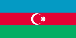
| Flag of Azerbaijan | |
The Azerbaijan Democratic Republic proclaimed its independence from the Transcaucasian Democratic Federative Republic in 1918 and became the first secular democratic Muslim-majority state. In 1920, the country was incorporated into the Soviet Union as the Azerbaijan SSR. The modern Republic of Azerbaijan proclaimed its independence on 30 August 1991, shortly before the dissolution of the Soviet Union in the same year. In September 1991, the ethnic Armenian majority of the Nagorno-Karabakh region formed the self-proclaimed Republic of Artsakh. The region and seven surrounding districts are internationally recognized as part of Azerbaijan pending a solution to the status of the Nagorno-Karabakh through negotiations facilitated by the OSCE, although became de facto independent with the end of the First Nagorno-Karabakh War in 1994. Following the Second Nagorno-Karabakh War in 2020, the seven districts and parts of Nagorno-Karabakh were returned to Azerbaijani control.
Currency / Language
| ISO | Currency | Symbol | Significant figures |
|---|---|---|---|
| AZN | Azerbaijani manat | ₼ | 2 |
| ISO | Language |
|---|---|
| HY | Armenian language |
| AZ | Azerbaijani language |
| RU | Russian language |


