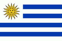
Uruguay, officially the Oriental Republic of Uruguay or the Eastern Republic of Uruguay (República Oriental del Uruguay), is a country in South America. It shares borders with Argentina to its west and southwest and Brazil to its north and northeast, while bordering the Río de la Plata to the south and the Atlantic Ocean to the southeast. It is part of the Southern Cone region of South America. Uruguay covers an area of approximately 181,034 km2 and has a population of an estimated 3,507,384 of whom around 2 million live in the metropolitan area of its capital and largest city, Montevideo.
The area that became Uruguay was first inhabited by groups of hunter–gatherers 13,000 years ago. The predominant tribe at the moment of the arrival of Europeans was the Charrúa people, when the Portuguese first established Colónia do Sacramento in 1680; Uruguay was colonized by Europeans late relative to neighboring countries. The Spanish founded Montevideo as a military stronghold in the early 18th century because of the competing claims over the region. Uruguay won its independence between 1811 and 1828, following a four-way struggle between Portugal and Spain, and later Argentina and Brazil. It remained subject to foreign influence and intervention throughout the 19th century, with the military playing a recurring role in domestic politics. A series of economic crises and the political repression against left-wing guerrilla activity in the late 1960s and early 1970s put an end to a democratic period that had begun in the early 20th century, culminating in the 1973 coup d'état, which established a civic-military dictatorship. The military government persecuted leftists, socialists, and political opponents, resulting in deaths and numerous instances of torture by the military; the military relinquished power to a civilian government in 1985. Uruguay is today a democratic constitutional republic, with a president who serves as both head of state and head of government.