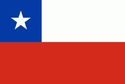
Map - Parral, Chile (Parral)

Parral (Parral)
Parral is a city and commune in the Linares Province of Chile's Maule Region.

Parral is located 40 km south of Linares and 97 kilometers south of Talca, on the southern border of the Maule Region and Linares Province. Parral borders on the north with the communes of Longaví, Retiro and Colbún (with which it shares a short border in the cordillerana zone); on the west with the commune of Cauquenes (Cauquenes Province); on the south with the commune of Ñiquén and San Fabián and Ñuble Region); and on the east, with the commune of San Fabián.

The commune of Parral is 1638.4 km2 in area. The river Perquilauquén forms its southern border.
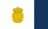
 
Map - Parral (Parral)
Map
Google - Map - Parral, Chile
Google
Google Earth - Map - Parral, Chile
Google Earth
Nokia - Map - Parral, Chile
Nokia
Openstreetmap - Map - Parral, Chile
Openstreetmap
Map - Parral - Esri.WorldImagery
Esri.WorldImagery
Map - Parral - Esri.WorldStreetMap
Esri.WorldStreetMap
Map - Parral - OpenStreetMap.Mapnik
OpenStreetMap.Mapnik
Map - Parral - OpenStreetMap.HOT
OpenStreetMap.HOT
Map - Parral - OpenTopoMap
OpenTopoMap
Map - Parral - CartoDB.Positron
CartoDB.Positron
Map - Parral - CartoDB.Voyager
CartoDB.Voyager
Map - Parral - OpenMapSurfer.Roads
OpenMapSurfer.Roads
Map - Parral - Esri.WorldTopoMap
Esri.WorldTopoMap
Map - Parral - Stamen.TonerLite
Stamen.TonerLite
Country - Chile
Currency / Language  
ISO Currency Symbol Significant figures
CLP Chilean peso $ 0
CLF Unidad de Fomento 4
ISO Language
ES Spanish language
Neighbourhood - Country  
  •  Argentina 
  •  Bolivia 
  •  Peru