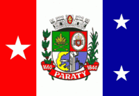
Map - Paraty

Paraty
Paraty (or Parati, ) is a preserved Portuguese colonial (1500–1822) and Brazilian Imperial (1822–1889) municipality with a population of about 43,000. Indeed, the name "Paraty" originates from the local Guaianá Indians' Indigenous Tupi language, inspired by an abundant local fish native to the region. Paraty is located on the Costa Verde (Green Coast), a lush green corridor that runs along the coastline of the state of Rio de Janeiro, in Brazil. Paraty has become a tourist destination, known for its historic town center and the coast and mountains in the region. The historic center of the city, as well as four areas of the Atlantic Forest, were inscribed on UNESCO World Heritage List in 2019 under the title "Paraty and Ilha Grande".

The town is located on the Bay of Ilha Grande, which is dotted with many tropical islands. Rising as high as 1,300 meters behind the town are tropical forests, mountains, and waterfalls. It is the southernmost and westernmost city in Rio de Janeiro state.

Paraty is listed by IPHAN as a National Historic Landmark. More than 80% of its territory is protected by conservation units: Nearby is the Serra do Mar State Park of São Paulo. The municipality also includes an indigenous village and an Afro-Brazilian quilombo settlement.

* Cairuçu Environmental Protection Area, where the village of Trindade is located

* Tamoios Ecological Station

* Serra da Bocaina National Park

* Baia de Paraty, Paraty Mirim and Saco do Mamanguá Environmental Protection Area

* Juatinga Ecological Reserve

 
Map - Paraty
Map
Google - Map - Paraty
Google
Google Earth - Map - Paraty
Google Earth
Nokia - Map - Paraty
Nokia
Openstreetmap - Map - Paraty
Openstreetmap
Map - Paraty - Esri.WorldImagery
Esri.WorldImagery
Map - Paraty - Esri.WorldStreetMap
Esri.WorldStreetMap
Map - Paraty - OpenStreetMap.Mapnik
OpenStreetMap.Mapnik
Map - Paraty - OpenStreetMap.HOT
OpenStreetMap.HOT
Map - Paraty - OpenTopoMap
OpenTopoMap
Map - Paraty - CartoDB.Positron
CartoDB.Positron
Map - Paraty - CartoDB.Voyager
CartoDB.Voyager
Map - Paraty - OpenMapSurfer.Roads
OpenMapSurfer.Roads
Map - Paraty - Esri.WorldTopoMap
Esri.WorldTopoMap
Map - Paraty - Stamen.TonerLite
Stamen.TonerLite
Country - Brazil
Currency / Language  
ISO Currency Symbol Significant figures
BRL Brazilian real R$ 2
Neighbourhood - Country  
  •  Argentina 
  •  Bolivia 
  •  Colombia 
  •  French Guiana 
  •  Guyana 
  •  Paraguay 
  •  Peru 
  •  Suriname 
  •  Uruguay 
  •  Venezuela 
Administrative Subdivision
City, Village,...