Oudomxay Province (Khouèng Oudômxai)
It covers an area of 15370 km2. It borders China to the north, Phongsali province to the northeast, Luang Prabang province to the east and southeast, Xaignabouli province to the south and southwest, Bokeo province to the west, and Luang Namtha province to the northwest. Its topography is mountainous, between 300 - 1800 m above sea level.
Oudomxay has deposits of salt, bronze, zinc, antimony, brown coal, kaolin and iron. Attempts to control heroin-related poppy cultivation there have been made through the Narcotics Crop Control Project, begun in the 1990s. Besides rice, important local crops are corn, soybeans, fruits, vegetables, cassava (maniok), sugarcane, tobacco, cotton wool, tea and peanuts. In 2004, approximately 10,000 tons of sugarcane and 45,000 tons of corn were produced there.
According to local history books, the first people who settled in Oudomxay around the year 700 were "Khom" (also known as Khmu). About 1260, Lao Ly came from the region of Sipsongpanna in southern China and built a village called Ban Luang Cheng ("big village" or "big district") in the area of today's province capital Muang Xay. The former Lao Ly village is now part of Muang Xaya and is called Bang Cheng.
Ly culture, which was marked by Buddhism on the one hand and the old Khom traditions on the other hand, grew and became very influential on the region. Khom and Leu lived together and shared the same rice fields. To provide protection they erected fortifications between the villages of Na Sao and Na Lai. Around 1828, Hmong tribes coming from China began to settle in Oudomxay. The modern province was created in 1976, when it was split off from Luang Prabang. Around 1987 the capital of the province was moved from Ban Nahin to Muang Xay. In 1992, the districts Paktha and Pha Oudom were reassigned to Bokeo province.
Map - Oudomxay Province (Khouèng Oudômxai)
Map
Country - Laos
 |
 |
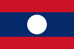
| Flag of Laos | |
Present-day Laos traces its historic and cultural identity to Lan Xang, which existed from the 13th century to the 18th century as one of the largest kingdoms in Southeast Asia. Because of its central geographical location in Southeast Asia, the kingdom became a hub for overland trade and became wealthy economically and culturally. After a period of internal conflict, Lan Xang broke into three separate kingdoms: Luang Phrabang, Vientiane and Champasak. In 1893, the three territories came under a French protectorate and were united to form what is now known as Laos. It briefly gained independence in 1945 after Japanese occupation but was re-colonised by France until it won autonomy in 1949. Laos became independent in 1953, with a constitutional monarchy under Sisavang Vong. A post-independence civil war began, which saw the communist resistance, supported by the Soviet Union, fight against the monarchy that later came under influence of military regimes supported by the United States. After the Vietnam War ended in 1975, the communist Pathet Lao came to power, ending the civil war. Laos was then dependent on military and economic aid from the Soviet Union until its dissolution in 1991.
Currency / Language
| ISO | Currency | Symbol | Significant figures |
|---|---|---|---|
| LAK | Lao kip | â‚ | 2 |
| ISO | Language |
|---|---|
| EN | English language |
| FR | French language |
| LO | Lao language |


