Ouagadougou Airport (Ouagadougou Airport)
Ouagadougou Airport, officially Thomas Sankara International Airport Ouagadougou, is an international airport in the center of the capital city of Ouagadougou in Burkina Faso. It was built in the 1960s, and it is approximately 1.5 km southeast of the main commercial area. The site itself is approximately 4.8 km in length, 0.5 km in width at its narrowest point, and covers an area of approximately 4.26 km2. Its runway is 3000 m long. When the airport was built it was on the southern boundary of the city. Ouagadougou has since experienced rapid urbanization and the airport is now surrounded by urban development.
Besides having outgrown its capacity constraints, Ouagadougou Airport is a source of pollution and risk. The government has plans for a new airport 30 km north of the capital.
In addition to civilian traffic, the airport has a military sector.
Ouagadougou Airport handles about 98% of all scheduled commercial air traffic in Burkina Faso. Air Burkina and Air France handle about 60% of scheduled passenger traffic. Between 2005 and 2011, air passenger traffic at Ouagadougou airport grew at an average annual rate of 7.0%, reaching about 404,726 passengers in 2011 and was estimated to reach 850,000 by 2025.
In 2007 it was the 15th busiest airport in West Africa in passenger volume, just ahead of Port Harcourt (Nigeria) and behind Banjul (Gambia).
The total air cargo grew 71% from 4,350 tons in 2005 to about 7,448 tons in 2009.
| IATA Code | OUA | ICAO Code | DFFD | FAA Code | |
|---|---|---|---|---|---|
| Telephone | Fax | ||||
| Home page |
Map - Ouagadougou Airport (Ouagadougou Airport)
Map
Country - Burkina_Faso
 |
 |
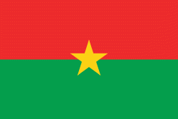
| Flag of Burkina Faso | |
The largest ethnic group in Burkina Faso is the Mossi people, who settled the area in the 11th and 13th centuries. They established powerful kingdoms such as the Ouagadougou, Tenkodogo, and Yatenga. In 1896, it was colonized by the French as part of French West Africa; in 1958, Upper Volta became a self-governing colony within the French Community. In 1960, it gained full independence with Maurice Yaméogo as president. Throughout the decades post independence, the country was subject to instability, droughts, famines and corruption. Various coups have also taken place in the country, in 1966, 1980, 1982, 1983, 1987, and twice in 2022, in January and in September, as well as an attempt in 1989 and another in 2015.
Currency / Language
| ISO | Currency | Symbol | Significant figures |
|---|---|---|---|
| XOF | West African CFA franc | Fr | 0 |
| ISO | Language |
|---|---|
| FR | French language |


