Otopeni (Oraş Otopeni)
 |
Henri Coandă International Airport is located inside Otopeni. The head office of the airline TAROM is located inside the International Departures Terminal in the airport. In addition the head office of Țiriac Air is in Otopeni.
The oldest discovered human settlements in the region are very old. On the occasion of excavations in 1966 to expand the nearby Henri Coandă International Airport, archaeologist Margaret Constantiniu of the History Museum of Bucharest identified fragments of ancient pottery and other objects that belonged to an important human settlements existing since the first period of the Iron Age. In an overlay was discovered another settlement are dated to the 10th century.
By charter of 14 February 1587, Mihnea Turcitul – voivode of Wallachia – gave Holy Trinity Monastery half to the village of Islazul and half to the village of Hodopeni (today Otopeni) mills and gypsies.
On 20 May 1620, Maria, great Băneasa, Holy Trinity monastery was given back (later Radu Vodă) half the village Hodopeni with Rumani, given by Master Villa, commanding Ruman listen. Historian Constantin C. Giurescu argued that the name Hodopeni comes from Hodopa or Hodoba.
At the end of the 19th century, Otopeni town was part of Dâmbovița County, Ilfov province, consisting of two villages, Lower Otopeni and Upper Otopeni, with 851 inhabitants in total. The commune operated a school with 29 students and two churches (one in each village). The village chambers were then part of the town Bucoveni, with 125 inhabitants.
Otopeni was transformed into a city as part of Nicolae Ceaușescu's Systematization plan. It replaced the semidetached houses with four-story high apartment buildings.
Map - Otopeni (Oraş Otopeni)
Map
Country - Romania
 |
 |
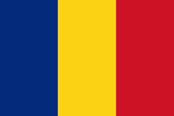
| Flag of Romania | |
Europe's second-longest river, the Danube, rises in Germany's Black Forest and flows southeasterly for 2857 km, before emptying into Romania's Danube Delta. The Carpathian Mountains cross Romania from the north to the southwest and include Moldoveanu Peak, at an altitude of 2544 m.
Currency / Language
| ISO | Currency | Symbol | Significant figures |
|---|---|---|---|
| RON | Romanian leu | lei | 2 |
| ISO | Language |
|---|---|
| HU | Hungarian language |
| RO | Romanian language |


