Otago Region (Otago)
The name "Otago" is the local southern Māori dialect pronunciation of "Ōtākou", the name of the Māori village near the entrance to Otago Harbour. The exact meaning of the term is disputed, with common translations being "isolated village" and "place of red earth", the latter referring to the reddish-ochre clay which is common in the area around Dunedin. "Otago" is also the old name of the European settlement on the harbour, established by the Weller Brothers in 1831, which lies close to Otakou. The upper harbour later became the focus of the Otago Association, an offshoot of the Free Church of Scotland, notable for its adoption of the principle that ordinary people, not the landowner, should choose the ministers.
Major centres include Dunedin (the principal city), Oamaru (made famous by Janet Frame), Balclutha, Alexandra, and the major tourist centres Queenstown and Wānaka. Kaitangata in South Otago is a prominent source of coal. The Waitaki and Clutha rivers provide much of the country's hydroelectric power. Vineyards and wineries have been developed in the Central Otago wine region. Some parts of the area originally covered by Otago Province are now administered by either Canterbury Regional Council or Southland Regional Council.
The Otago settlement, an outgrowth of the Free Church of Scotland, was founded in March 1848 with the arrival of the first two immigrant ships from Greenock on the Firth of Clyde — the John Wickliffe and the Philip Laing. Captain William Cargill, a veteran of the Peninsular War, was the secular leader. Otago citizens subsequently elected him to the office of provincial Superintendent after the New Zealand provinces were created in 1853.
The Otago Province was the whole of New Zealand from the Waitaki River south, including Stewart Island and the sub-Antarctic islands. It included the territory of the later Southland Province and also the much more extensive lands of the modern Southland Region. Initial settlement was concentrated on the port and city, then expanded, notably to the south-west, where the fertile Taieri Plains offered good farmland. The 1860s saw rapid commercial expansion after Gabriel Read discovered gold at Gabriel's Gully near Lawrence, and the Central Otago goldrush ensued.
Veterans of goldfields in California and Australia, plus many other fortune-seekers from Europe, North America and China, poured into the then Province of Otago, eroding its Scottish Presbyterian character. Further gold discoveries at Clyde and on the Arrow River around Arrowtown led to a boom, and Otago became for a period the cultural and economic centre of New Zealand. New Zealand's first daily newspaper, the Otago Daily Times, originally edited by Julius Vogel, dates from this period.
New Zealand's first university, the University of Otago, was founded in 1869 as the provincial university in Dunedin.
The Province of Southland separated from Otago Province and set up its own Provincial Council at Invercargill in 1861. After difficulties ensued, Otago re-absorbed it in 1870. Its territory is included in the southern region of the old Otago Province which is named after it and is now the territory of the Southland region. The provincial governments were abolished in 1876 when the Abolition of the Provinces Act came into force on 1 November 1876, and were replaced by other forms of local authority, including counties. Two in Otago were named after the Scottish independence heroes Wallace and Bruce. From this time the national limelight gradually shifted northwards.
Map - Otago Region (Otago)
Map
Country - New_Zealand
 |
 |
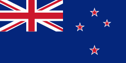
| Flag of New Zealand | |
The islands of New Zealand were the last large habitable land to be settled by humans. Between about 1280 and 1350, Polynesians began to settle in the islands and then developed a distinctive Māori culture. In 1642, the Dutch explorer Abel Tasman became the first European to sight and record New Zealand. In 1840, representatives of the United Kingdom and Māori chiefs signed the Treaty of Waitangi, which in its English version declared British sovereignty over the islands. In 1841, New Zealand became a colony within the British Empire. Subsequently, a series of conflicts between the colonial government and Māori tribes resulted in the alienation and confiscation of large amounts of Māori land. New Zealand became a dominion in 1907; it gained full statutory independence in 1947, retaining the monarch as head of state. Today, the majority of New Zealand's population of 5.1 million is of European descent; the indigenous Māori are the largest minority, followed by Asians and Pacific Islanders. Reflecting this, New Zealand's culture is mainly derived from Māori and early British settlers, with recent broadening of culture arising from increased immigration. The official languages are English, Māori, and New Zealand Sign Language, with the local dialect of English being dominant.
Currency / Language
| ISO | Currency | Symbol | Significant figures |
|---|---|---|---|
| NZD | New Zealand dollar | $ | 2 |
| ISO | Language |
|---|---|
| EN | English language |


