Map - Orange Walk District (Orange Walk District)

Orange Walk District (Orange Walk District)
Orange Walk District is a district in the northwest of the nation of Belize, with its district capital in Orange Walk Town.

The Orange Walk District, with an area of 1,829 square miles (4,636 square km), is located north-northwest of the Belize District. This is the second largest district in terms of total area in comparison to other districts in Belize, and lies between the Belize and Corozal districts to the east, Mexico to the north and Guatemala to the west. Villages in Orange Walk District include August Pine Ridge, Blue Creek, Carmelita, Chan Pine Ridge, Douglas, Indian Church, Guinea Grass, San Antonio, San Carlos, San Estevan, San Felipe, San José, San Jose Palmar, Nuevo San Juan, San Lazaro, San Luis, San Pablo, San Román, Santa Cruz, Santa Martha, Shipyard, Trial Farm, Trinidad and Yo Creek. Other settlements with smaller numbers of inhabitants may also be found, as well as ancient Mayan sites such as Cuello, Lamanai, Noh Mul and Chan Chich. The Rio Bravo Conservation and Management Area, a large private nature reserve in the Yalbac Hills, is also located in this district. The land is highly cultivated with sugar cane, sorghum, rice, corn and vegetables, with a significant amount of this agriculture done by Mennonite farmers. According to the Statistical Institute of Belize, the Orange Walk District had an estimated population of 45,419 persons for the 2010 population and housing census; 13,400 of these persons lived in the urban area of Orange Walk Town while 32,019 lived in rural areas.
 
Map - Orange Walk District (Orange Walk District)
Country - Belize
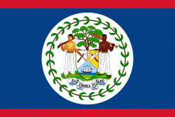
Flag of Belize
Belize (Bileez) is a country on the north-eastern coast of Central America. It is bordered by Mexico to the north, the Caribbean Sea to the east, and Guatemala to the west and south. It also shares a water boundary with Honduras to the southeast. It has an area of 8867 sqmi and a population of 441,471 (2022). Its mainland is about 290 km long and 110 km wide. It is the least populated and least densely populated country in Central America. Its population growth rate of 1.87% per year (2018 estimate) is the second-highest in the region and one of the highest in the Western Hemisphere. Its capital is Belmopan, and its largest city is the namesake city of Belize City. Belize is often thought of as a Caribbean country in Central America because it has a history similar to that of English-speaking Caribbean nations. Belize's institutions and official language reflect its history as a British colony.

The Maya civilization spread into the area of Belize between 1500 BC and AD 300 and flourished until about 1200. European contact began in 1492 when Christopher Columbus sailed along the Gulf of Honduras. European exploration was begun by English settlers in 1638. Spain and Britain both laid claim to the land until Britain defeated the Spanish in the Battle of St. George's Caye (1798). In 1840 it became a British colony known as British Honduras, and a Crown colony in 1862. Belize achieved its independence from the United Kingdom on 21 September 1981. It is the only mainland Central American country which is a Commonwealth realm, with King Charles III as its monarch and head of state, represented by a governor-general.
Currency / Language  
ISO Currency Symbol Significant figures
BZD Belize dollar $ 2
Neighbourhood - Country  
  •  Guatemala 
  •  Mexico 
Administrative Subdivision
Country, State, Region,...
City, Village,...