Oeiras Municipality (Oeiras)
 |
 |
Oeiras is an important economic hub, being one of the most highly developed municipalities of Portugal and Europe. It has the highest GDP per capita in the country, being also the second highest-ranking municipality (immediately after Lisbon) in terms of purchasing power as well as the second highest-ranking in the country as far as tax collection is concerned. These economic indicators also reflect the education level of its inhabitants, as Oeiras is the municipality with the highest concentration of population by tertiary education attainment in the country, their entrepreneurial prowess and the economically liberal mindset of Oeiras' society in general. It also has the lowest unemployment rate in the Lisbon area.
The mild climate, access to water, quality of its soils and geographically advantageous location at the mouth of the Tagus River attracted early settlement to this region. The rugged hilltops of the interior conditioned cultivation and allowed the settlement of several small agricultural castros within the region's limits, such as Castro of Leceia (which was classified in 1963 as a property of public interest). This archaeological site is a witness to the early settlements and defensive structures that developed during the Chalcolithic period, although Paleolithic camps such as Gruta da Ponte da Laje are indicative of earlier settlements.
Remnants of the Roman occupation of the Iberian peninsula are evident in many places throughout the municipality, including mosaics, specifically along the Rua das Alcássimas, and a Roman bridge. The later Arab conquest left behind several toponymic markers, including Arab/Moorish place names such as Alcássimas, Algés, Alpendroado and Quinta da Moura.
Map - Oeiras Municipality (Oeiras)
Map
Country - Portugal
 |
 |
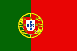
| Flag of Portugal | |
One of the oldest countries in Europe, its territory has been continuously settled, invaded and fought over since prehistoric times. The territory was first inhabited by pre-Roman and Celtic peoples who had contact with Phoenicians, ancient Greeks and Carthaginians. It was later ruled by the Romans, followed by the invasions of Germanic peoples and the Islamic invasion by the Moors, whose rule was eventually expelled during the Reconquista. Founded first as a county of the Kingdom of León in 868, gained its independence as the Kingdom of Portugal with the Treaty of Zamora in 1143.
Currency / Language
| ISO | Currency | Symbol | Significant figures |
|---|---|---|---|
| EUR | Euro | € | 2 |
| ISO | Language |
|---|---|
| PT | Portuguese language |


