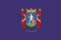
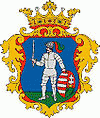
Nógrád County (Nógrád megye)
 |
 |
Nógrád county lies in northern Hungary. It shares borders with Slovakia and the Hungarian counties Pest, Heves and Borsod-Abaúj-Zemplén. The capital of Nógrád county is Salgótarján. Its area is 2,544 km². It is the smallest county by population and the second smallest by area (after Komárom-Esztergom).
Nógrád is famous for its historic architecture of ancient Gothic churches and stone castles dated to the 13th century. Some historic landmarks includes the Salgó Castle and several baroque buildings constructed in the 18th century and the Vay, Teleki. Much of the northern border of the county is formed by the river Ipoly. The mountain ranges Börzsöny, Cserhát and Mátra lie partly in the county.
Due to the mountains, the county is characterised by small villages nestled in the valleys. The two largest settlements are Balassagyarmat, the former county seat, and Salgótarján, which has become a center of industry in the early 20th century due to coal mines nearby.
Map - Nógrád County (Nógrád megye)
Map


Country - Hungary
 |
 |
| Flag of Hungary | |
The territory of present-day Hungary has for centuries been a crossroads for various peoples, including Celts, Romans, Germanic tribes, Huns, West Slavs and the Avars. The foundation of the Hungarian state was established in the late 9th century AD with the conquest of the Carpathian Basin by Hungarian grand prince Árpád. His great-grandson Stephen I ascended the throne in 1000, converting his realm to a Christian kingdom. By the 12th century, Hungary became a regional power, reaching its cultural and political height in the 15th century. Following the Battle of Mohács in 1526, it was partially occupied by the Ottoman Empire (1541–1699). Hungary came under Habsburg rule at the turn of the 18th century, later joining with the Austrian Empire to form Austria-Hungary, a major power into the early 20th century.
Currency / Language
| ISO | Currency | Symbol | Significant figures |
|---|---|---|---|
| HUF | Hungarian forint | Ft | 2 |
| ISO | Language |
|---|---|
| HU | Hungarian language |

