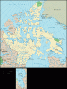
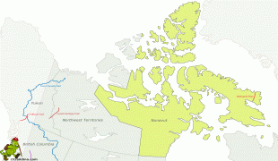
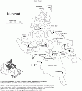
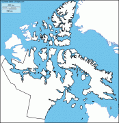
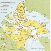
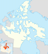
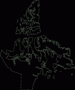
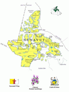
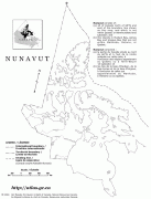
Nunavut
 |
 |
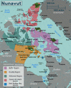
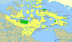
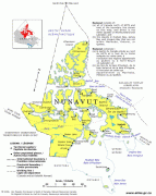
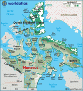
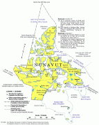
Nunavut comprises a major portion of Northern Canada and most of the Arctic Archipelago. Its vast territory makes it the fifth-largest country subdivision in the world, as well as North America's second-largest (after Greenland). The capital Iqaluit (formerly Frobisher Bay), on Baffin Island in the east, was chosen by a capital plebiscite in 1995. Other major communities include the regional centres of Rankin Inlet and Cambridge Bay.
Nunavut also includes Ellesmere Island to the far north, as well as the eastern and southern portions of Victoria Island in the west, and all islands in Hudson, James and Ungava bays, including Akimiski Island far to the southeast of the rest of the territory. It is Canada's only geo-political region that is not connected to the rest of North America by highway.
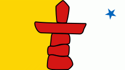
Nunavut is the least populous of Canada's provinces and territories. One of the world's most remote, sparsely settled regions, Nunavut has a population of 39,589 (2021 figure, up from 35,944 in 2016), consisting mostly of Inuit. The population occupies a land area of just over 1877787 km2, or slightly smaller than Mexico (excluding water surface area). Nunavut is also home to the world's northernmost permanently inhabited place, Alert. Eureka, a weather station on Ellesmere Island, has the lowest average annual temperature of any Canadian weather station.
Map - Nunavut
Map


Country - Canada
 |
 |
| Flag of Canada | |
Indigenous peoples have continuously inhabited what is now Canada for thousands of years. Beginning in the 16th century, British and French expeditions explored and later settled along the Atlantic coast. As a consequence of various armed conflicts, France ceded nearly all of its colonies in North America in 1763. In 1867, with the union of three British North American colonies through Confederation, Canada was formed as a federal dominion of four provinces. This began an accretion of provinces and territories and a process of increasing autonomy from the United Kingdom. This widening autonomy was highlighted by the Statute of Westminster 1931 and culminated in the Canada Act 1982, which severed the vestiges of legal dependence on the Parliament of the United Kingdom.
Currency / Language
| ISO | Currency | Symbol | Significant figures |
|---|---|---|---|
| CAD | Canadian dollar | $ | 2 |
| ISO | Language |
|---|---|
| EN | English language |
| FR | French language |
| IU | Inuktitut |
