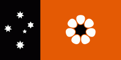
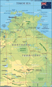
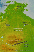
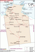
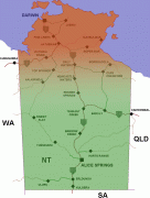
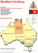
Northern Territory (Northern Territory)
 |
 |
The NT covers 1349129 km2, making it the third-largest Australian federal division, and the 11th-largest country subdivision in the world. It is sparsely populated, with a population of only 249,000 – fewer than half as many people as in Tasmania. The largest population center is the capital city of Darwin.
The archaeological history of the Northern Territory may have begun more than 60,000 years ago when humans first settled this region of the Sahul Continent. Reportedly the Makassan traders began a relationship with the indigenous people of the Northern Territory around the trading of trepang from at least the 18th century. The coast of the territory was first seen by Europeans in the 17th century. The British were the first Europeans to attempt to settle the coastal regions. After three failed attempts to establish a settlement (1824–1828, 1838–1849, and 1864–1866), success was achieved in 1869 with the establishment of a settlement at Port Darwin.
The economy is based largely on mining and petroleum, which during 2018–2019 contributed 23% of the gross state product, or $5.68 billion, accounting for 92.4% of exports.
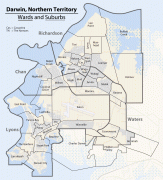
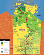
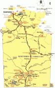
The territory's population is concentrated in coastal regions and along the Stuart Highway. Besides the capital of Darwin, the major settlements are (in order of size) Palmerston, Alice Springs, Katherine, Nhulunbuy and Tennant Creek. Residents of the Northern Territory are often known simply as "Territorians" and fully as "Northern Territorians", or more informally as "Top Enders" and "Centralians".
Humans have lived in the present area of the Northern Territory since at least 48,400 to 68,700 years ago, and for at least the last five centuries of that time, extensive seasonal trade links existed between the Indigenous peoples of this area and what is now Indonesia.
With the coming of the British, there were four early attempts to settle the harsh environment of the northern coast, of which three failed in starvation and despair. The land now occupied by the Northern Territory was part of colonial New South Wales from 1825 to 1863, except for a brief time from February to December 1846, when it was part of the short-lived colony of North Australia. The Northern Territory was part of South Australia from 1863 to 1911. Under the administration of colonial South Australia, the overland telegraph was constructed between 1870 and 1872.
From its establishment in 1869 the Port of Darwin was the major Territory supply for many decades.
A railway was built between Palmerston and Pine Creek between 1883 and 1889. The economic pattern of cattle raising and mining was established so that by 1911 there were 513,000 cattle. Victoria River Downs was at one time the largest cattle station in the world. Gold was found at Grove Hill in 1872 and at Pine Creek (in 1871), Brocks Creek, Burundi, and copper was found at Daly River.
On 1 January 1911, a decade after federation, the Northern Territory was separated from South Australia, alongside the Australian Capital Territory from NSW, and transferred to federal control. Alfred Deakin opined at this time "To me the question has been not so much commercial as national, first, second, third and last. Either we must accomplish the peopling of the northern territory or submit to its transfer to some other nation." In late 1912 there was growing sentiment that the name "Northern Territory" was unsatisfactory. The names "Kingsland" (after King George V and to correspond with Queensland), "Centralia" and "Territoria" were proposed with Kingsland becoming the preferred choice in 1913. However, the name change never went ahead.
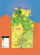
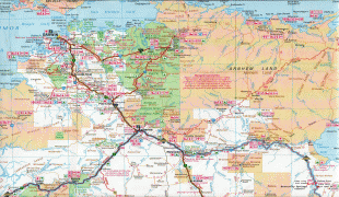
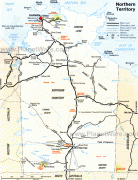
Map - Northern Territory (Northern Territory)
Map


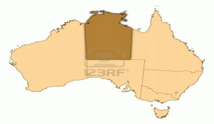
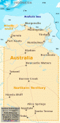
Country - Australia
 |
 |
| Flag of Australia | |
The ancestors of Aboriginal Australians began arriving from south east Asia approximately 65,000 years ago, during the last ice age. Arriving by sea, they settled the continent and had formed approximately 250 distinct language groups by the time of European settlement, maintaining some of the longest known continuing artistic and religious traditions in the world. Australia's written history commenced with the European maritime exploration of Australia. The Dutch navigator Willem Janszoon was the first known European to reach Australia, in 1606. In 1770, the British explorer James Cook mapped and claimed the east coast of Australia for Great Britain, and the First Fleet of British ships arrived at Sydney in 1788 to establish the penal colony of New South Wales. The European population grew in subsequent decades, and by the end of the 1850s gold rush, most of the continent had been explored by European settlers and an additional five self-governing British colonies established. Democratic parliaments were gradually established through the 19th century, culminating with a vote for the federation of the six colonies and foundation of the Commonwealth of Australia on 1 January 1901. Australia has since maintained a stable liberal democratic political system and wealthy market economy.
Currency / Language
| ISO | Currency | Symbol | Significant figures |
|---|---|---|---|
| AUD | Australian dollar | $ | 2 |
| ISO | Language |
|---|---|
| EN | English language |