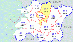
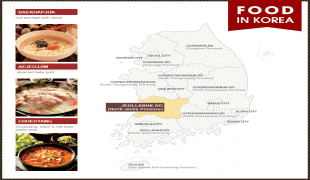
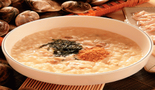
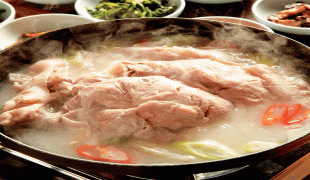
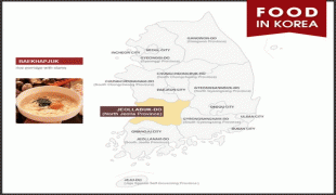
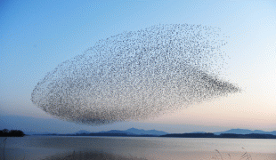
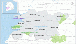
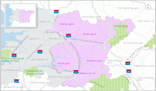
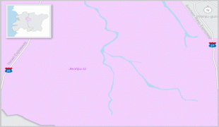
North Jeolla Province (Jeollabuk-do)
 |
Jeonju is the capital and largest city of North Jeolla, with other major cities including Iksan, Gunsan, and Jeongeup.
North Jeolla was established in 1896 from the province of Jeolla, one of the Eight Provinces of Korea, consisting of the northern half of its mainland territory.
During the Proto-Three Kingdoms period, Jeolla region was the center of the Mahan confederacy among Samhan. There were 15 tribal countries out of 54 in the region. During the period of the Three States, this region came to belong to Baekje when it absorbed Mahan. Baekje was destroyed by the Silla and Chinese Tang dynasty allied force in 660 (20th year of King Uija) and ruled by Tang. It became a part of Silla when Tang was expelled in 676 (16th year of King Munmu).
When there were nine states and five small capitals in Unified Silla in 685, there were Wansan-ju (present Jeonju) and Namwon-gyeong (present Namwon) in Jeollabuk-do in existence.
In 892, when General Gyeon Hwon founded Hubaekje (later Baekje), this area was the center of the country for about 50 years. In 936, during the rule of Singeom, it was attributed to Goryeo Dynasty. From 900 to the time when Hubaekje was attributed to Goryeo, Wansan-ju (present Jeonju) had been its capital, and the country ruled the whole Jeolla-do region.
In 996 (14th year of King Seongjong), this region was named Gangnam province and the Korean government established the four states (Jeonju-Jeonju, Yeongju-Gobu, Sunju-Sunchang, and Maju-Okgu) in the North Jeolla region.
Gangnam-do (Jeonbuk) and Haenam-do (Jeonnam) were combined and titled as Jeolla-do in 1018 (9th year of King Hyeonjong's reign).
During the Joseon Dynasty, as the administrative districts of the whole nation were organized in the Eight Provinces system in 1413 (13th year of King Taejong's reign), Jeolla-do took charge of vast areas of one prefecture, four autonomous counties, four protectorates, 12 counties, and 31 counties covering present Jeollanam-do, Jeollabuk-do and Jeju-do.
In 1896 (33rd year of King Gojong's reign), the whole country was divided into 13 provinces. Jeolla-do was divided into Jeollanam-do and Jeollabuk-do. Jeollabuk-do consisted of 26 counties.
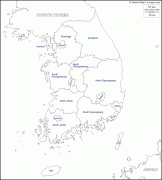
Map - North Jeolla Province (Jeollabuk-do)
Map


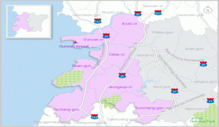


Country - South_Korea
 |
 |
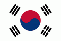
| Flag of South Korea | |
The Korean Peninsula was inhabited as early as the Lower Paleolithic period. Its first kingdom was noted in Chinese records in the early 7th century BCE. Following the unification of the Three Kingdoms of Korea into Silla and Balhae in the late 7th century, Korea was ruled by the Goryeo dynasty (918–1392) and the Joseon dynasty (1392–1897). The succeeding Korean Empire (1897–1910) was annexed in 1910 into the Empire of Japan. Japanese rule ended following Japan's surrender in World War II, after which Korea was divided into two zones; a northern zone occupied by the Soviet Union and a southern zone occupied by the United States. After negotiations on reunification failed, the southern zone became the Republic of Korea in August 1948 while the northern zone became the communist Democratic People's Republic of Korea the following month.
Currency / Language
| ISO | Currency | Symbol | Significant figures |
|---|---|---|---|
| KRW | South Korean won | â‚© | 0 |
| ISO | Language |
|---|---|
| EN | English language |
| KO | Korean language |


