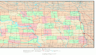
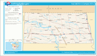
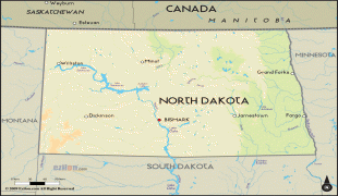
North Dakota (North Dakota)
 |
 |
North Dakota is the 19th largest state, but with a population of less than 780,000 as of 2020, it is the 4th least populous and 4th most sparsely populated. The capital is Bismarck while the largest city is Fargo, which accounts for nearly a fifth of the state's population; both cities are among the fastest-growing in the U.S., although half of all residents live in rural areas. The state is part of the Great Plains region, with broad prairies, steppe, temperate savanna, badlands, and farmland being defining characteristics.
What is now North Dakota was inhabited for thousands of years by various Native American tribes, including the Mandan, Hidatsa, and Arikara along the Missouri River; the Ojibwa and Cree in the northeast; and several Sioux groups (the Assiniboine, Yankton, Wahpeton, and Teton) across the rest of the state. European explorers and traders first arrived in the early 18th century, mostly in pursuit of lucrative furs. The United States acquired the region in the early 19th century, gradually settling it amid growing resistance by increasingly displaced natives.
The Dakota Territory, established in 1861, became central to American pioneers, with the Homestead Act of 1862 precipitating significant population growth and development. The traditional fur trade declined in favor of farming, particularly of wheat; the subsequent Dakota Boom from 1878 to 1886 saw giant farms stretched across the rolling prairies, with the territory becoming a key breadbasket and regional economic engine. The Northern Pacific and Great Northern railway companies competed for access to lucrative grain centers; farmers banded together in political and socioeconomic alliances that were core to the broader Populist Movement of the Midwest.
North Dakota was admitted to the Union on November 2, 1889, along with neighboring South Dakota, as the 39th and 40th states. President Benjamin Harrison shuffled the statehood papers before signing them so that no one could tell which became a state first; consequently, the two states are officially numbered in alphabetical order. Statehood marked the gradual winding down of the pioneer period, with the state fully settled by around 1920. Subsequent decades saw a rise in radical agrarian movements and economic cooperatives, of which one legacy is the Bank of North Dakota, the only state-run bank in the U.S.
Beginning in the mid 20th century, North Dakota's rich natural resources became more critical to economic development; into the 21st century, oil extraction from the Bakken formation in the northwest has played a major role in the state's prosperity. Such development has led to unprecedented population growth (along with high birth rates) and reduced unemployment, with North Dakota having the second lowest unemployment rate in the U.S. (after Hawaii). It ranks relatively well in metrics such as infrastructure, quality of life, economic opportunity, and public safety.
Map - North Dakota (North Dakota)
Map


Country - United_States
 |
 |
| Flag of the United States | |
Indigenous peoples have inhabited the Americas for thousands of years. Beginning in 1607, British colonization led to the establishment of the Thirteen Colonies in what is now the Eastern United States. They quarreled with the British Crown over taxation and political representation, leading to the American Revolution and proceeding Revolutionary War. The United States declared independence on July 4, 1776, becoming the first nation-state founded on Enlightenment principles of unalienable natural rights, consent of the governed, and liberal democracy. The country began expanding across North America, spanning the continent by 1848. Sectional division surrounding slavery in the Southern United States led to the secession of the Confederate States of America, which fought the remaining states of the Union during the American Civil War (1861–1865). With the Union's victory and preservation, slavery was abolished nationally by the Thirteenth Amendment.
Currency / Language
| ISO | Currency | Symbol | Significant figures |
|---|---|---|---|
| USD | United States dollar | $ | 2 |
| ISO | Language |
|---|---|
| EN | English language |
| FR | French language |
| ES | Spanish language |