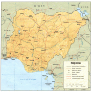
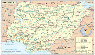
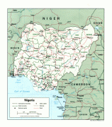
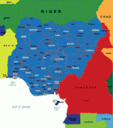
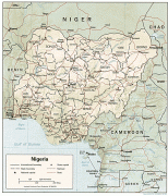
Nigeria (Federal Republic of Nigeria)
 |
 |
| Flag of Nigeria | |
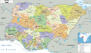
Nigeria has been home to several indigenous pre-colonial states and kingdoms since the second millennium BC, with the Nok civilization in the 15th century BC, marking the first internal unification in the country. The modern state originated with British colonialization in the 19th century, taking its present territorial shape with the merging of the Southern Nigeria Protectorate and Northern Nigeria Protectorate in 1914 by Lord Lugard. The British set up administrative and legal structures while practising indirect rule through traditional chiefdoms in the Nigeria region. Nigeria became a formally independent federation on 1 October 1960. It experienced a civil war from 1967 to 1970, followed by a succession of military dictatorships and democratically elected civilian governments until achieving a stable democracy in the 1999 presidential election. The 2015 general election was the first time an incumbent president failed to be re-elected.
Nigeria is a multinational state inhabited by more than 250 ethnic groups speaking 500 distinct languages, all identifying with a wide variety of cultures. The three largest ethnic groups are the Hausa in the north, Yoruba in the west, and Igbo in the east, together constituting over 60% of the total population. The official language is English, chosen to facilitate linguistic unity at the national level. Nigeria's constitution ensures freedom of religion and it is home to some of the world's largest Muslim and Christian populations. Nigeria is divided roughly in half between Muslims, who live mostly in the north, and Christians, who live mostly in the south; indigenous religions, such as those native to the Igbo and Yoruba ethnicities, are in the minority.
Nigeria is a regional power in Africa and a middle and emerging power in international affairs. Nigeria's economy is the largest in Africa, the 31st-largest in the world by nominal GDP, and 26th-largest by PPP. Nigeria is often referred to as the Giant of Africa owing to its large population and economy and is considered to be an emerging market by the World Bank. However, the country ranks very low in the Human Development Index and remains one of the most corrupt nations in the world. Nigeria is a founding member of the African Union and a member of many international organizations, including the United Nations, the Commonwealth of Nations, NAM, the Economic Community of West African States, Organisation of Islamic Cooperation and OPEC. It is also a member of the informal MINT group of countries and is one of the Next Eleven economies.
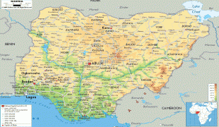
The name Nigeria was taken from the Niger River running through the country. This name was coined on 8 January 1897, by the British journalist Flora Shaw, who later married Frederick Lugard, a British colonial administrator. The neighbouring Republic of Niger takes its name from the same river. The origin of the name Niger, which originally applied to only the middle reaches of the Niger River, is uncertain. The word is likely an alteration of the Tuareg name egerew n-iger ewen used by inhabitants along the middle reaches of the river around Timbuktu before 19th-century European colonialism.
Currency / Language
| ISO | Currency | Symbol | Significant figures |
|---|---|---|---|
| NGN | Nigerian naira | ₦ | 2 |
| ISO | Language |
|---|---|
| EN | English language |
| HA | Hausa language |
| IG | Igbo language |
| YO | Yoruba language |