Nida (Nida)
Nida (Nidden, Kursenieki: Nīde) is a resort town in Lithuania, the administrative centre of Neringa municipality. Located on the Curonian Spit between the Curonian Lagoon and the Baltic Sea, it is the westernmost point of Lithuania and the Baltic states, close to the border with the Russian Kaliningrad Oblast exclave. It currently has about 2,385 residents.
A settlement area of the Baltic Curonians, the original place called nida ("fluent" in the Old Prussian language) was first mentioned in 1385 documents issued by the Teutonic Knights, who ruled the lands within their Monastic State. The original settlement on the road along the Curonian Spit from Königsberg to Memel was located about 5 km south of its today's position near the Hohe Düne (High Dune) at Cape Grobštas (from Old Prussian: grabis, "hill"). In 1454, King Casimir IV Jagiellon incorporated the region to the Kingdom of Poland upon the request of the anti-Teutonic Prussian Confederation. After the subsequent Thirteen Years' War (1454–1466), the fishing village became a part of Poland as a fief held by the Teutonic Knights until 1525, and by Ducal Prussia afterwards, and thus was located within the Polish–Lithuanian union and Commonwealth.
From 1701, it was part of the Kingdom of Prussia. In 1709 nearly all of the population died from a bubonic plague epidemic. Continuously threatened by sand drifts, the village was moved away from the approaching dune to today's position in the 1730s. Incorporated into the Prussian Province of East Prussia in 1773, it became part of the German Empire upon the German unification of 1871. In 1874 a lighthouse on Urbas hill was built, later destroyed in the war and rebuilt in 1945 and 1953. In 1878, the village had a population of 655, mostly living off fishing, with fish being sold mainly to nearby Klaipėda and other coastal towns. Nida already was the largest village of the Curonian Spit. Both Lithuanian and German-language church services were held there.
Map - Nida (Nida)
Map
Country - Lithuanian_Soviet_Socialist_Republic_(1918–1919)
 |
 |
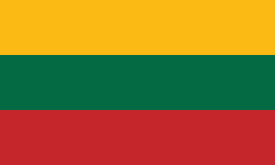
| Flag of Lithuania | |
Germany had lost World War I and signed the Compiègne Armistice on 11 November 1918. Its military forces then started retreating from the former Ober Ost territories. Two days later, the government of the Soviet Russia renounced the Treaty of Brest-Litovsk, which had assured Lithuania's independence. Soviet forces then launched a westward offensive against Estonia, Latvia, Lithuania, Poland and Ukraine in an effort to spread the global proletarian revolution and replace national independence movements with Soviet republics. Their forces followed retreating German troops and reached Lithuania by the end of December 1918.
Currency / Language
| ISO | Currency | Symbol | Significant figures |
|---|---|---|---|
| EUR | Euro | € | 2 |
| ISO | Language |
|---|---|
| LT | Lithuanian language |
| PL | Polish language |
| RU | Russian language |


