Nanumea
Located along one edge of the so-called Polynesian triangle, Nanumea lies just south of the Gilbert Islands, which are Micronesian in language and culture. Nanumea is a classic atoll, a series of low islets sitting on a coral reef shelf surrounding a lagoon. About 12 km long by 2.5 km wide in overall size, the dry land area is about 3.9 sqkm. The two largest islets Nanumea and Lakena, which comprise 90% of the dry land area of the atoll.
Since the early 1990s, the use of nets and spearing has been prohibited in all parts of the lagoon and the Nanumea Conservation Area was established in 2006. The Nanumea Conservation Area covers about 2 sqkm of the central lagoon and consists of about 10% of the reef area of the atoll, including marine habitats and 2 islets. A survey of the conservation zone was conducted in 2010.
The largest villages are Haumaefa with 187 people (2012) and Lolua with 187 people (2012). The junior school is Kaumaile Primary School. There are scattered households across the lagoon from Nanumea village at Matagi and on Motu Foliki, and on the southeastern tip of Lakena islet. Aside from Nanumea and Lakena there are three much smaller islets, Motu Foliki, Lafogaki and Te Afua-a-Taepoa spread around the encircling reef flat. There are 2 mangrove forests, a small patch to the south of Nanumea and another on the islet of Lakena.
The pulaka pits are located on Lakena, as the Nanumeans want the main island of Nanumea to remain mosquito free. Pulaka (swamp taro) is grown in large pits of composted soil below the water table.
In 2011, the kou leafworm (Ethmia nigroapicella) had a devastating impact on Nanumea by stripping the leaves of the Kanava trees (Cordia subcordata, beach cordia). The Kanava trees provide coastal protection, wind shelter, shade and are habitats for sea birds. The flowers of the Kanava are also locally prized.
In March 2015 Nanumea suffered damage to houses, crops and infrastructure as the result of storm surges caused by Cyclone Pam.
Map - Nanumea
Map
Country - Tuvalu
 |
 |
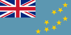
| Flag of Tuvalu | |
The first inhabitants of Tuvalu were Polynesians, according to well-established theories regarding a migration of Polynesians into the Pacific that began about three thousand years ago. Long before European contact with the Pacific islands, Polynesians frequently voyaged by canoe between the islands. Polynesian navigation skills enabled them to make elaborately planned journeys in either double-hulled sailing canoes or outrigger canoes. Scholars believe that the Polynesians spread out from Samoa and Tonga into the Tuvaluan atolls, which then served as a stepping stone for further migration into the Polynesian outliers in Melanesia and Micronesia.
Currency / Language
| ISO | Currency | Symbol | Significant figures |
|---|---|---|---|
| AUD | Australian dollar | $ | 2 |
| ISO | Language |
|---|---|
| EN | English language |
| SM | Samoan language |


