Makhalaneng (Nako)
Makhalaneng is a community council located in the Maseru District of Lesotho. The population in 2006 was 13,146.
The community of Makhalaneng includes the villages of Aupolasi, Bochabela, Borata, Ha Abele, Ha Chake, Ha Chere (Koung), Ha Dinizulu, Ha Fane, Ha Fokoane, Ha Joele, Ha Kali, Ha Kelebone, Ha Kori, Ha Kou (Maliphokoana), Ha Lefeko, Ha Leholi, Ha Lejaha, Ha Lekota, Ha Lekunutu, Ha Lesooana, Ha Letsema, Ha Lithathane, Ha Makhema, Ha Makoae, Ha Maloma, Ha Mammenyana, Ha Maphephe, Ha Maphoma, Ha Masakale, Ha Maseru (Aupolasi), Ha Matšaba, Ha Matšoana, Ha Metsing, Ha Mohale-a-Phala, Ha Moitšupeli, Ha Mojakane, Ha Mojakopo, Ha Mokheseng, Ha Mokhou, Ha Mokola, Ha Molahloe, Ha Moora, Ha Moshe, Ha Motale, Ha Mothibeli, Ha Motjotji, Ha Motlelepe, Ha Motsoafa, Ha Nako, Ha Nkabane, Ha Ntima, Ha Pelei, Ha Phathang, Ha Pholo, Ha Potiane, Ha Raboletsi, Ha Rakhati, Ha Raleqheka, Ha Ramosoeu, Ha Raqoane, Ha Sematle, Ha Seoloana, Ha Serabele, Ha Shoaepane, Ha Talasi, Ha Tlali, Ha Tlapana, Ha Toki (Moqoakong), Ha Tšehla, Ha Tsuu, Kena (Ha Matheatlala), Kena (Ha Mothibeli), Kena (Ha Tsola), Koqong, Koung, Likhoaleng, Liphakoeng, Lithabaneng, Maama, Maholong, Mantša-tlala, Matsoapong, Motlejoa, Motse-Mocha (Ha Lekunutu), Rabolinyane, Sekukurung, Terae, Thaba-Chitja and Tholang.
The community of Makhalaneng includes the villages of Aupolasi, Bochabela, Borata, Ha Abele, Ha Chake, Ha Chere (Koung), Ha Dinizulu, Ha Fane, Ha Fokoane, Ha Joele, Ha Kali, Ha Kelebone, Ha Kori, Ha Kou (Maliphokoana), Ha Lefeko, Ha Leholi, Ha Lejaha, Ha Lekota, Ha Lekunutu, Ha Lesooana, Ha Letsema, Ha Lithathane, Ha Makhema, Ha Makoae, Ha Maloma, Ha Mammenyana, Ha Maphephe, Ha Maphoma, Ha Masakale, Ha Maseru (Aupolasi), Ha Matšaba, Ha Matšoana, Ha Metsing, Ha Mohale-a-Phala, Ha Moitšupeli, Ha Mojakane, Ha Mojakopo, Ha Mokheseng, Ha Mokhou, Ha Mokola, Ha Molahloe, Ha Moora, Ha Moshe, Ha Motale, Ha Mothibeli, Ha Motjotji, Ha Motlelepe, Ha Motsoafa, Ha Nako, Ha Nkabane, Ha Ntima, Ha Pelei, Ha Phathang, Ha Pholo, Ha Potiane, Ha Raboletsi, Ha Rakhati, Ha Raleqheka, Ha Ramosoeu, Ha Raqoane, Ha Sematle, Ha Seoloana, Ha Serabele, Ha Shoaepane, Ha Talasi, Ha Tlali, Ha Tlapana, Ha Toki (Moqoakong), Ha Tšehla, Ha Tsuu, Kena (Ha Matheatlala), Kena (Ha Mothibeli), Kena (Ha Tsola), Koqong, Koung, Likhoaleng, Liphakoeng, Lithabaneng, Maama, Maholong, Mantša-tlala, Matsoapong, Motlejoa, Motse-Mocha (Ha Lekunutu), Rabolinyane, Sekukurung, Terae, Thaba-Chitja and Tholang.
Map - Makhalaneng (Nako)
Map
Country - Lesotho
 |
 |
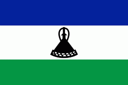
| Flag of Lesotho | |
It was previously the British Crown colony of Basutoland, which was given independence by the United Kingdom on 4 October 1966. It is a fully sovereign state and is a member of the United Nations, the Commonwealth of Nations, the African Union, and the Southern African Development Community. The name Lesotho roughly translates to "land of the Sotho".
Currency / Language
| ISO | Currency | Symbol | Significant figures |
|---|---|---|---|
| LSL | Lesotho loti | L | 2 |
| ZAR | South African rand | Rs | 2 |
| ISO | Language |
|---|---|
| EN | English language |
| ST | Sotho language |
| XH | Xhosa language |
| ZU | Zulu language |


