Musa Qala District (Mūsá Qal‘ah)
Musa Qala is a district in the north of Helmand Province, Afghanistan. Its population was around 57,500 in 2012 and are 97% ethnic Pashtun. The district centre is the village of Musa Qala; there are 19 other large villages and 200 smaller settlements, mostly along the Musa Qala River. The area is irrigated by the Helmand and Arghandab Valley Authority.
NATO-led International Security Assistance Force extended its presence to this region in mid-2006. Musa Qala, along with the rest of Helmand, was to be under the responsibility of British forces.
The village of Musa Qala was the scene of fierce fighting between British Pathfinder Platoon troops and Taliban insurgents during the summer of 2006. The British had set up a stronghold in the local governor's office and faced daily waves of determined attacks. The British garrison was later relieved by a Danish infantry team who faced renewed insurgent attacks, culminating in better-trained militant fighters equipped with rockets and mortars. After a month of these attacks, the fighting died down, and the Danish forces handed control of the base back to British forces. On 17 October 2006, after a 35-day lull in violence, the British left the village, handing over control to the local elders' council.
On January 1979, Musa Qala fell to Nasim Akhundzada after a battle against a pro-government militia led by Ghulam Dastgar Mahali, and the district governor, Zabit Aulleah, fled. Three days later, Afghan forces captured the district and installed the new district governor from Nangarhar, Sher Gul. On February 1979, the government withdrew its army, and Nasim Akhudzada recaptured Musa Qala and executed thirty elders who cooperated with the government.
On August 26, 2015, Taliban fighters seized control of district headquarters from Afghan forces.
Map - Musa Qala District (Mūsá Qal‘ah)
Map
Country - Afghanistan
 |
 |
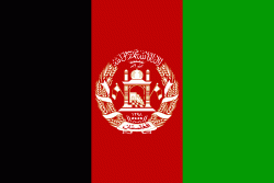
| Flag of Afghanistan | |
Human habitation in Afghanistan dates back to the Middle Paleolithic era, and the country's strategic location along the historic Silk Road has led it to being described, picturesquely, as the ‘roundabout of the ancient world’. Popularly referred to as the graveyard of empires, the land has historically been home to various peoples and has witnessed numerous military campaigns, including those by the Persians, Alexander the Great, the Maurya Empire, Arab Muslims, the Mongols, the British, the Soviet Union, and most recently by a US-led coalition. Afghanistan also served as the source from which the Greco-Bactrians and the Mughals, amongst others, rose to form major empires. The various conquests and periods in both the Iranian and Indian cultural spheres made the area a center for Zoroastrianism, Buddhism, Hinduism, and later Islam throughout history.
Currency / Language
| ISO | Currency | Symbol | Significant figures |
|---|---|---|---|
| AFN | Afghan afghani | Ø‹ | 2 |
| ISO | Language |
|---|---|
| PS | Pashto language |
| FA | Persian language |
| TK | Turkmen language |
| UZ | Uzbek language |


