Musakhel District (Mūsa Khel District)
Musakhail is a district in the northeast of the Balochistan province of Pakistan. It became a separate district in 1992, prior to which it was a tehsil within Loralai District. Musakhail District is now part of Loralai Division is created after splitting Zhob Division.
After the first phase of the Afghan war of 1878-79 AD, the British took control of the northern areas of Balochistan under the Treaty of Gandamak. During 1879-84 AD, efforts were made to extend the British influence over the Khetrans and Musakhels of the, now Musakhel, territory. The Musakhels took part in outrages committed by the Kakars under Shah Jahan in 1884, but surrendered to the British government on the conclusion of the expedition in the same year. On 1 November 1887, the whole area was declared part of British India. Zhob agency was formed in 1890 and Musakhel territory was annexed to it. Musakhel was made a tehsil in 1892 and was transferred to Loralai district in October 1903.
In 1905, the Musakhel tehsil comprised 61 villages and the total population, according to 1901 census, was 15,537 (8,374 males and 7,163 females). The principal tribes represented were: Isot (1,941); Jafar (1,026); Panri (10,144) including the Musakhel clan (9,748) the principal divisions of which were the Belkhel (7,662) and Laharzai (2,086); and Syed Gharshin (271). The chief language spoken was Pushto. Musakhel remained a tehsil of Loralai district till 1 January 1992 when it was notified as a district as a result of splitting Loralai district into 3 districts, Loralai, Musakhel, and Barkhan.
Map - Musakhel District (Mūsa Khel District)
Map
Country - Pakistan
 |
 |
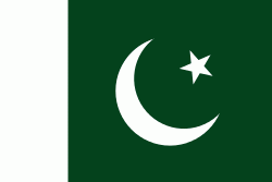
| Flag of Pakistan | |
Pakistan is the site of several ancient cultures, including the 8,500-year-old Neolithic site of Mehrgarh in Balochistan, the Indus Valley civilisation of the Bronze Age, the most extensive of the civilisations of the Afro-Eurasia, and the ancient Gandhara civilization. The region that comprises the modern state of Pakistan was the realm of multiple empires and dynasties, including the Achaemenid; briefly that of Alexander the Great; the Seleucid, the Maurya, the Kushan, the Gupta; the Umayyad Caliphate in its southern regions, the Hindu Shahis, the Ghaznavids, the Delhi Sultanate, the Mughals, the Durranis, the Omani Empire, the Sikh Empire, British East India Company rule, and most recently, the British Indian Empire from 1858 to 1947.
Currency / Language
| ISO | Currency | Symbol | Significant figures |
|---|---|---|---|
| PKR | Pakistani rupee | ₨ | 2 |
| ISO | Language |
|---|---|
| EN | English language |
| PA | Panjabi language |
| PS | Pashto language |
| SD | Sindhi language |
| UR | Urdu |


