Santo Tomás (Municipio de Santo Tomás)
Santo Tomás is a town and a municipality in the Chontales Department of Nicaragua. It is located 179 km from Managua and 40 km from Juigalpa on the paved highway to Rama, en route to the Atlantic Coast.
The main economic activities are agriculture and livestock. Many of the businesses located in Santo Tomás consist of small stores owned by individuals that live next to their commercial properties. One of the oldest pharmacies in the region, Lopez Pharmacy, whose owner was cofounder of the Red Cross in Santo Tomás, is located in the town. This town is the "quesillo capitol" of Nicaragua, where the rivers run with milk and the rocks are made of the local cheese: donde los ríos son de leche y las piedras de cuajada.
The climate is generally hot, but much more pleasant and breezy than the scorching lowlands of Managua and Leon. The rainy season typically starts in late May and runs until December. Global climate change has adversely affected the rainy seasons, negatively impacting crop production and health of livestock. In November and December, the temperature cools down considerably.
Map - Santo Tomás (Municipio de Santo Tomás)
Map
Country - Nicaragua
 |
 |
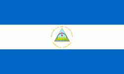
| Flag of Nicaragua | |
Originally inhabited by various indigenous cultures since ancient times, the region was conquered by the Spanish Empire in the 16th century. Nicaragua gained independence from Spain in 1821. The Mosquito Coast followed a different historical path, being colonized by the English in the 17th century and later coming under British rule. It became an autonomous territory of Nicaragua in 1860 and its northernmost part was transferred to Honduras in 1960. Since its independence, Nicaragua has undergone periods of political unrest, dictatorship, occupation and fiscal crisis, including the Nicaraguan Revolution of the 1960s and 1970s and the Contra War of the 1980s.
Currency / Language
| ISO | Currency | Symbol | Significant figures |
|---|---|---|---|
| NIO | Nicaraguan córdoba | C$ | 2 |
| ISO | Language |
|---|---|
| EN | English language |
| ES | Spanish language |


