Mount Obama (Mount Obama)
Boggy Peak, named Mount Obama from 2009 to 2016, is the highest point of the Shekerley Mountains on the island of Antigua. It lies in the southwest region of the island, and rises to a height of 402 m.
The area has significant cultural heritage as it was used during slavery times for sugarcane plantations. The name originated from slave masters telling stories about the dangers of the Boogie Man who took spirits and lived up in the mountains. This was to discourage slaves from escaping and running into the mountains. Runaways were able to make their own settlements in the mountains and actually live out their lives apart from enslavement.
On August 4, 2009, the peak was renamed Mount Obama by then-Prime Minister Baldwin Spencer, after United States president Barack Obama. The original name was restored in 2016 by cabinet decision.
Map - Mount Obama (Mount Obama)
Map
Country - Antigua_and_Barbuda
 |
 |
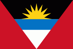
| Flag of Antigua and Barbuda | |
The country consists of two major islands, Antigua and Barbuda, which are approximately 40 km apart, and several smaller islands, including Great Bird, Green, Guiana, Long, Maiden, Prickly Pear, York, and Redonda. The permanent population is approximately 97,120 ( estimates), with 97% residing in Antigua. St. John's, Antigua, is the country's capital, major city, and largest port. Codrington is Barbuda's largest town.
Currency / Language
| ISO | Currency | Symbol | Significant figures |
|---|---|---|---|
| XCD | East Caribbean dollar | $ | 2 |
| ISO | Language |
|---|---|
| EN | English language |


