Monte Plata Province (Provincia de Monte Plata)
 |
The province is bordered to the north by the Sánchez Ramírez, Duarte and Samaná provinces, to the east by the Hato Mayor and San Pedro de Macorís provinces, to the south the province of Santo Domingo, and to the west by the provinces of San Cristóbal and Monseñor Nouel.
The territory that the province of Monte Plata occupies today, was part of the Taino chiefdom of Higüey or Icayagua. The establishment of the population that today lives in the northern enclaves of the city of Santo Domingo and that bear the names Monte Plata and Bayaguana are a consequence of the so-called devastations of Ozorio (1605-1606), the Spanish authorities, in 1603 decided by means of a Royal Decree to depopulate the northwest area of the island in order to eliminate the smuggling of cattle, hides and other products that was being produced by that part of the island.
The populations with their belongings from the cities of Monte Cristi, Puerto Plata, Bayajá and Yaguana were transferred to the southeast of the island where two new cities named Monte Plata and Bayaguana were founded, the names of these cities are the result of the fusion of Monte Cristi and Puerto Plata, and Bayajá and Yaguana.
On May 7, 1842, a strong earthquake shook the city of Monte Plata. One day before the proclamation of Dominican independence in 1844, General Matías Moreno announced independence in Monte Plata, while summoning the troops under his command to march towards the city of Santo Domingo. Monte Plata was also the scene of the Battle of Bermejo, on September 30, 1863. In it the Spanish troops faced against Dominican nationalist. The Spanish left Monte Plata on March 7, 1864; the restorative forces immediately occupied the square. The next day President Salcedo established his headquarters in Monte Plata. On that same date, he appointed Benigno Filomeno Rojas as general in chief of the eastern armies, replacing General Luperón. President Salcedo remained in Monte Plata for 6 days, until March 13. On April 23, 1868 Buenaventura Báez was proclaimed President of the Republic in Monte Plata. At the end of 1879 the combat of Porquero or Arroyo Porquero between liberals, represented by Ulises Heureaux, and conservatives, loyal to President Cesáreo Guillermo, took place in Monte Plata. It was an action of the utmost importance since, with the triumph of Heureaux, the political dominance of the Cibao over the south was established.
Starting in 1930, the urban aspect of Monte Plata was outlined with the construction of the square, the church, the market and the park, thanks to the management of the priest Emiliano Camarena. Inhabitants of the surrounding sections came to the city on the first Friday of each month to exchange their products.
Map - Monte Plata Province (Provincia de Monte Plata)
Map
Country - Dominican_Republic
 |
 |
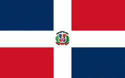
| Flag of the Dominican Republic | |
The native Taíno people had inhabited Hispaniola before the arrival of Europeans, dividing it into five chiefdoms. They had constructed an advanced farming and hunting society, and were in the process of becoming an organized civilization. The Taínos also inhabited Cuba, Jamaica, Puerto Rico, and the Bahamas. The Genoese mariner Christopher Columbus explored and claimed the island for Castile, landing there on his first voyage in 1492. The colony of Santo Domingo became the site of the first permanent European settlement in the Americas and the first seat of Spanish colonial rule in the New World. It would also become the site to introduce importations of enslaved Africans to the Americas. In 1697, Spain recognized French dominion over the western third of the island, which became the independent state of Haiti in 1804.
Currency / Language
| ISO | Currency | Symbol | Significant figures |
|---|---|---|---|
| DOP | Dominican peso | $ | 2 |
| ISO | Language |
|---|---|
| ES | Spanish language |


