Mokhotlong District (Mokhotlong)
As of 2006, the district had a population of 97,713 which was 5.21 per cent of the total population of the country. The total area of the district was 4,075 which was 13.42 per cent of the total area of the country. The density of population in the district was 24.00 per km2. The total area planted in crops in 2009 was 16,420 hectares, which formed 4.07 per cent of the total area planted in crops in the country. The total agricultural production was 8,757 tonnes, which was 5.82 per cent of the total agricultural production in the country.
As of 2006, the district had a population of 97,713, 5.21 per cent of the population of the country. The area of the district was 4,075, 13.42 per cent of the country. The population density was 24.00 persons per square kilometre, compared to 62 for the country as a whole. There were four constituencies and fifteen community councils in the district. As of 2006, 250 people tested HIV positive, 17.70 of the HIV positive persons in the country. 97 of these (13.00%) were men; 153 (20.60%) were women.
Map - Mokhotlong District (Mokhotlong)
Map
Country - Lesotho
 |
 |
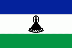
| Flag of Lesotho | |
It was previously the British Crown colony of Basutoland, which was given independence by the United Kingdom on 4 October 1966. It is a fully sovereign state and is a member of the United Nations, the Commonwealth of Nations, the African Union, and the Southern African Development Community. The name Lesotho roughly translates to "land of the Sotho".
Currency / Language
| ISO | Currency | Symbol | Significant figures |
|---|---|---|---|
| LSL | Lesotho loti | L | 2 |
| ZAR | South African rand | Rs | 2 |
| ISO | Language |
|---|---|
| EN | English language |
| ST | Sotho language |
| XH | Xhosa language |
| ZU | Zulu language |


