Mohamed Boudiaf International Airport (Mohamed Boudiaf International Airport)
Mohamed Boudiaf International Airport is an airport in Algeria, located approximately 9 km south of Constantine; about 320 km east-southeast of Algiers.
The airport was built in 1943 as Constantine Airfield by the United States Army during the World War II North African Campaign. It was primarily a maintenance and supply depot for Air Technical Service Command and also served as headquarters for XII Bomber Command as a command and control base. It also was used as a command post for Allied Forces Command (AFHQ) for Free French, British and United States ground forces in Algeria in February 1943, under the command of General Sir Harold R. L. G. Alexander to coordinate the actions of the United States First Army advancing from the west and the British Eighth Army, advancing from the east against the German Afrika Korps. In 1944 it was turned over to the Algerian government and used occasionally by Air Transport Command aircraft on the North African route until the end of the war.
The airport is named for President Mohamed Boudiaf. Muhammad Boudiaf (June 23, 1919 – June 29, 1992) (Arabic: محمد بوضياف), also called Si Tayeb el Watani, was an Algerian political leader and a founder of the revolutionary National Liberation Front (FLN) that led the Algerian War of Independence (1954–1962).
| IATA Code | CZL | ICAO Code | DABC | FAA Code | |
|---|---|---|---|---|---|
| Telephone | 00213318101.01to07 | Fax | 0021331810117 | ||
| Home page | Hyperlink |
Map - Mohamed Boudiaf International Airport (Mohamed Boudiaf International Airport)
Map
Country - Algeria
 |
|
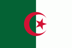
| Flag of Algeria | |
Algeria produced and is linked to many civilizations, empires and dynasties, including ancient Numidians, Phoenicians, Carthaginians, Romans, Vandals, Byzantines, Umayyads, Abbasids, Rustamids, Idrisids, Aghlabids, Fatimids, Zirids, Hammadids, Almoravids, Almohads, Zayyanids, Spaniards, Ottomans and the French colonial empire, with the latter expanded into its present-boundaries. After 132 years of being part of France, tensions between France and the local Algerian populace led to the start of the Algerian War which concluded with Algeria obtaining its independence on 5 July 1962 with the establishment of the People's Democratic Republic on 20 September of that year.
Currency / Language
| ISO | Currency | Symbol | Significant figures |
|---|---|---|---|
| DZD | Algerian dinar | دج | 2 |
| ISO | Language |
|---|---|
| AR | Arabic language |


