Mirabal sisters (Provincia de Hermanas Mirabal)
The Mirabal sisters (hermanas Mirabal ) were four sisters from the Dominican Republic, three of whom (Patria, Minerva and María Teresa) opposed the dictatorship of Rafael Trujillo (el Jefe) and were involved in clandestine activities against his regime. The three sisters were assassinated on 25 November 1960. The last sister, Adela "Dedé", who was not involved in political activities at the time, died of natural causes on 1 February 2014.
The assassinations turned the Mirabal sisters into "symbols of both popular and feminist resistance". In 1999, in their honor, the United Nations General Assembly designated 25 November the International Day for the Elimination of Violence against Women.
The Mirabal family were farmers from the central Cibao region of the Dominican Republic and had a farm in the village of Ojo de Agua, near the town of Salcedo. The sisters were considered part of the social elite and were raised by their parents, Enrique Mirabal Fernández and Mercedes Reyes Camilo. All four sisters attended primary school in their village, Ojo de Agua, and attended a Catholic boarding school, El Colegio de la Inmaculada, for their secondary education in the city of La Vega. Once Rafael Trujillo took power it was customary to have a picture of him in the household, however, the Mirabal house never had a picture of Trujillo and were subsequently considered people in disagreement with the Trujillo regime.
Map - Mirabal sisters (Provincia de Hermanas Mirabal)
Map


Country - Dominican_Republic
 |
 |
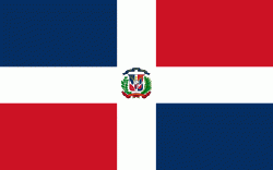
| Flag of the Dominican Republic | |
The native Taíno people had inhabited Hispaniola before the arrival of Europeans, dividing it into five chiefdoms. They had constructed an advanced farming and hunting society, and were in the process of becoming an organized civilization. The Taínos also inhabited Cuba, Jamaica, Puerto Rico, and the Bahamas. The Genoese mariner Christopher Columbus explored and claimed the island for Castile, landing there on his first voyage in 1492. The colony of Santo Domingo became the site of the first permanent European settlement in the Americas and the first seat of Spanish colonial rule in the New World. It would also become the site to introduce importations of enslaved Africans to the Americas. In 1697, Spain recognized French dominion over the western third of the island, which became the independent state of Haiti in 1804.
Currency / Language
| ISO | Currency | Symbol | Significant figures |
|---|---|---|---|
| DOP | Dominican peso | $ | 2 |
| ISO | Language |
|---|---|
| ES | Spanish language |