Mili Atoll (Mili Atoll)
Mili Atoll (Marshallese: Mile, ) is a coral atoll of 92 islands in the Pacific Ocean, and forms a legislative district of the Ratak Chain of the Marshall Islands. It is located approximately 78 km southeast of Arno. Its total land area is 14.9 km2 making it the second largest of the Marshall Islands after Kwajalein. It encloses a much smaller lagoon than Kwajalein, with an area of 760 km2. The atoll is separated by a water channel called the Klee Passage from the Knox Atoll which is considerably smaller. The population of Mili Atoll was 738 as of 2011. The main village is also called Mili. Other villages include Nallu, Enejet, Lukonor, Tokewa, and Wau, Mili. Nallu, Enejet and Lukonwor are only accessible from Mili by land during lowtide. Only Mili and Enejet have runways for small aircraft. Mili Airport and Enejit Airport are served by Air Marshall Islands when its aircraft are operational.
The British merchant vessel Rolla sighted several islands in the Ratak and Ralik Chains. On October 20, 1803, she sighted islands at 5.68333°N, 169.45°W, which was possibly Mili Atoll. Captain Cummings sent in a cutter, but the heavy surf prevented it from landing. Rolla had transported convicts from Britain to New South Wales and was on her way to Canton to find a cargo to take back to Britain.
In the early 19th century, Mili and Knox Atolls were designated the Mulgrave Islands by Adam Johann von Krusenstern. In 1823 the mutinous crew of the whaler Globe, out of Nantucket, Massachusetts, brought their ship to Mili Atoll. The mutineers, led by Samuel B. Comstock, had killed Globe's captain and her three officers. A few days after she anchored at Mili Atoll, Comstock was murdered by co-mutineer Silas Payne. Six of the crew fled in the ship, leaving nine men stranded on the island. By the time the U.S. schooner USS Dolphin (1821), commanded by Lieutenant Commander John Percival, arrived to rescue them two years later, the islanders had killed all but two of the crew members.
The infamous blackbirder Bully Hayes owned Tokowa Islet on Mili during the late 19th century and used it as a base for his operations. Mili Atoll was claimed by the German Empire along with the rest of the Marshall Islands in 1884. The Germans established a trading station and in 1870 a Christian church.
According to some theorists who advocate for the Japanese capture hypothesis of Amelia Earhart, Mili Atoll might have been where Earhart and Fred Noonan landed in 1937 after failing to make it to Howland Island. Evidence of this actually occurring, however, is largely based on unreliable eyewitness testimony rather than conclusive physical evidence; most historians believe Earhart and Noonan would have had no reason to attempt to come to Mili, and if they had, they would have run out of fuel before making it in any case.
Map - Mili Atoll (Mili Atoll)
Map
Country - Marshall_Islands
 |
 |
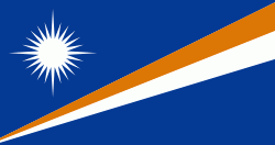
| Flag of the Marshall Islands | |
The country's population of 42,050 people (at the 2021 World Bank Census ) is spread out over five islands and 29 coral atolls, comprising 1,156 individual islands and islets. The capital and largest city is Majuro. It has the largest portion of its territory composed of water of any sovereign state, at 97.87%. The islands share maritime boundaries with Wake Island to the north, Kiribati to the southeast, Nauru to the south, and the Federated States of Micronesia to the west. About 52.3% of Marshall Islanders (27,797 at the 2011 Census) live on Majuro. In 2016, 73.3% of the population were defined as being "urban". The UN also indicates a population density of 295 PD/km2, and its projected 2020 population is 59,190.
Currency / Language
| ISO | Currency | Symbol | Significant figures |
|---|---|---|---|
| USD | United States dollar | $ | 2 |
| ISO | Language |
|---|---|
| EN | English language |
| MH | Marshallese language |


