Mid-Western Region (Madhya Pashchimanchal)
The Mid-Western Development Region (Nepali: मध्य-पश्चिमाञ्चल विकास क्षेत्र, Madhya-Pashchimānchal Bikās Kshetra) was one of the largest and formerly one of Nepal's five development regions. Westward from the Central region surrounding Kathmandu were the Western, Mid-Western and finally Far-Western regions. Counter-intuitively, Mid-Western lay west of Western.
It comprised three zones:
* Karnali
* Bheri
* Rapti
There were 15 districts in this region. The main rivers of this region were Karnali, Bheri, West Rapti River and Babai. Mt. Kanjiroba, Mt. Sisne and Mt. Patarasi were the main mountains of the Mid-Western Development Region. Banke National Park, Bardiya National Park, Shey Phoksundo National Park and Rara National Parks were some of the conservation areas of Mid-Western Development Region which were helping to attract more number of tourists. It occupied 29.2% of the total land of Nepal. It occupied an area of 42,378 km2
Bhutias, Brahmin, Chhetri, Magar, Tharu, Awadhi and Thakuri were the main ethnicities. They were involved in different occupations like farming, animal husbandry, tourism, and service. Ghorahi, Nepalgunj, Birendranagar were the major trade centres of Mid-Western Development Region. There were various types of industries such as steel manufacturing and a garment industry. Different types of cultural sites such as Swargadwari lied in this development region. Peoples of this development region celebrated numbers of festivals like Dashain, Tihar, Lhosar etc. They grew different types of food such as rice, maize, pulse, wheat, and paddy. Banke and Bardiya National Park, Dhorpatan Hunting Reserve, Rara National Park, Rara Lake, Swargadwari and other sacred places were in this development region. In addition, the Gorkh, Kanti and Mukti Himal were also located in this region.
Map - Mid-Western Region (Madhya Pashchimanchal)
Map


Country - Nepal
 |
 |
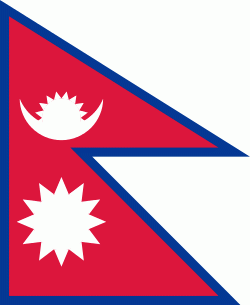
| Flag of Nepal | |
The name "Nepal" is first recorded in texts from the Vedic period of the Indian subcontinent, the era in ancient Nepal when Hinduism was founded, the predominant religion of the country. In the middle of the first millennium BC, Gautama Buddha, the founder of Buddhism, was born in Lumbini in southern Nepal. Parts of northern Nepal were intertwined with the culture of Tibet. The centrally located Kathmandu Valley is intertwined with the culture of Indo-Aryans, and was the seat of the prosperous Newar confederacy known as Nepal Mandala. The Himalayan branch of the ancient Silk Road was dominated by the valley's traders. The cosmopolitan region developed distinct traditional art and architecture. By the 18th century, the Gorkha Kingdom achieved the unification of Nepal. The Shah dynasty established the Kingdom of Nepal and later formed an alliance with the British Empire, under its Rana dynasty of premiers. The country was never colonised but served as a buffer state between Imperial China and British India. Parliamentary democracy was introduced in 1951 but was twice suspended by Nepalese monarchs, in 1960 and 2005. The Nepalese Civil War in the 1990s and early 2000s resulted in the establishment of a secular republic in 2008, ending the world's last Hindu monarchy.
Currency / Language
| ISO | Currency | Symbol | Significant figures |
|---|---|---|---|
| NPR | Nepalese rupee | ₨ | 2 |
| ISO | Language |
|---|---|
| EN | English language |
| NE | Nepali language |