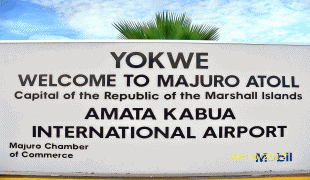
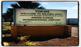
Marshall Islands International Airport (Amata Kabua International Airport)
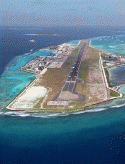
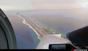
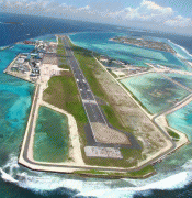
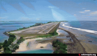
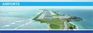
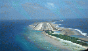
Marshall Islands International Airport, also known as Amata Kabua International Airport, is located in the western part of Rairok on the south side of Majuro Atoll, the capital of the Republic of the Marshall Islands. The airport was built during World War II (1943) on Anenelibw and Lokojbar islets. It replaced Majuro Airfield, a coral-surfaced airstrip at Delap Island near the eastern end of Majuro Atoll that had been originally constructed by Japanese occupation forces in 1942.
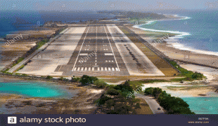
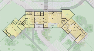
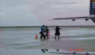
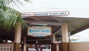
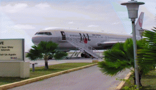
A series of single-floor structures (small hangars) make up the airport terminal. No physical structures existed at the airport prior to the 1970s. The current terminal structure and modern runway/apron were built in 1971. Passengers from flights arriving at the airport use stairs to exit aircraft and walk to the terminal.
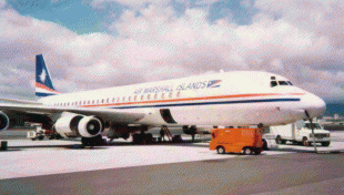
The airport is capable of handling all propeller-driven aircraft as well as midsize jet aircraft (e.g., Airbus A320s, Boeing 737s, Boeing 757s and Boeing 767s).
The Republic of the Marshall Islands Ports Authority replaced the Marshall Islands Airports Authority in managing the airport in 2003 under RMI Port Authority Act.
Sea walls have been added to prevent the sea from reclaiming the infill used to create the airport.
Between 2007 and 2009, airport improvement projects replaced the runway surfaces, rebuilt the apron to better handle aircraft, and repaved and added markings to the runway. In 2007 the US FAA added two new airport crash tenders to the existing three-tender fleet, as part of the airport improvement projects.
A series of single-floor structures (small hangars) make up the airport terminal. No physical structures existed at the airport prior to the 1970s. The current terminal structure and modern runway/apron were built in 1971. Passengers from flights arriving at the airport use stairs to exit aircraft and walk to the terminal.
The airport is capable of handling all propeller-driven aircraft as well as midsize jet aircraft (e.g., Airbus A320s, Boeing 737s, Boeing 757s and Boeing 767s).
The Republic of the Marshall Islands Ports Authority replaced the Marshall Islands Airports Authority in managing the airport in 2003 under RMI Port Authority Act.
Sea walls have been added to prevent the sea from reclaiming the infill used to create the airport.
Between 2007 and 2009, airport improvement projects replaced the runway surfaces, rebuilt the apron to better handle aircraft, and repaved and added markings to the runway. In 2007 the US FAA added two new airport crash tenders to the existing three-tender fleet, as part of the airport improvement projects.
| IATA Code | MAJ | ICAO Code | PKMJ | FAA Code | |
|---|---|---|---|---|---|
| Telephone | Fax | ||||
| Home page |
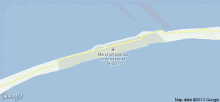
Map - Marshall Islands International Airport (Amata Kabua International Airport)


Country - Marshall_Islands
 |
 |
| Flag of the Marshall Islands | |
The country's population of 42,050 people (at the 2021 World Bank Census ) is spread out over five islands and 29 coral atolls, comprising 1,156 individual islands and islets. The capital and largest city is Majuro. It has the largest portion of its territory composed of water of any sovereign state, at 97.87%. The islands share maritime boundaries with Wake Island to the north, Kiribati to the southeast, Nauru to the south, and the Federated States of Micronesia to the west. About 52.3% of Marshall Islanders (27,797 at the 2011 Census) live on Majuro. In 2016, 73.3% of the population were defined as being "urban". The UN also indicates a population density of 295 PD/km2, and its projected 2020 population is 59,190.
Currency / Language
| ISO | Currency | Symbol | Significant figures |
|---|---|---|---|
| USD | United States dollar | $ | 2 |
| ISO | Language |
|---|---|
| EN | English language |
| MH | Marshallese language |