Marsa Alam (Marsa Alam)
Marsa Alam (مرسى علم Marsā ʿAlam, Classical Arabic ) is a town in south-eastern Egypt, located on the western shore of the Red Sea. It is currently seeing fast increasing popularity as a tourist destination and development following the opening of Marsa Alam International Airport in 2003.
Due to its crystal clear water and its white sandy beaches, it is also known as the "Egyptian Maldives".
Among the most famous beaches around Marsa Alam is the Abu Dabab beach. In Abu Dabab, turtles are a common sight. For tourists who seek to see something less typical, there is marine wildlife like crocodilefish and octopuses.
Marsa Alam is also known as the world-class kitesurfing destination and starting point for safaris.
Marsa Alam also has some inland attractions, such as the Emerald Mines and the Temple of Seti I at Khanais.
Despite being over 135 mi north of the tropical zone, the city experiences a tropical hot desert climate (Köppen: BWh), with steadier temperatures than places to the north such as Hurghada and Sharm el Sheikh, yet Kosseir is steadier and has cooler summers. Marsa Alam, Kosseir and Sharm el-Sheikh have the warmest night temperatures of all other Egyptian cities and resorts. Average maximum temperatures during January typically range from 22 to 25 °C and in August 33 to 40 °C. The temperature of the Red Sea at this location during the year ranges from 22 to 29 °C.
The highest record temperature was 45 C, recorded on May 10, 2010, while the lowest record temperature was 5 C, recorded on January 3, 2008.
Map - Marsa Alam (Marsa Alam)
Map


Country - United_Arab_Republic
 |
 |
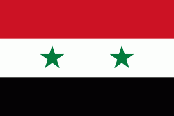
| Flag of Egypt | |
The republic was led by Egyptian President Gamal Abdel Nasser. The UAR was a member of the United Arab States, a loose confederation with the Mutawakkilite Kingdom of Yemen, which was dissolved in 1961.
Currency / Language
| ISO | Currency | Symbol | Significant figures |
|---|---|---|---|
| EGP | Egyptian pound | £ or جم | 2 |
| ISO | Language |
|---|---|
| AR | Arabic language |
| EN | English language |
| FR | French language |