Maritime Region (Maritime)
Other major cities in the Maritime region include Lomé, the Capital of Togo, and Aného.
Maritime is located south of Plateaux Region. In the west, it borders the Volta Region of Ghana, and in the east it borders two departments of Benin: Kouffo farther north, and Mono farther south.
Maritime is divided into the prefectures of Avé, Bas-Mono, Golfe, Lacs, Vo, Yoto, and Zio.
Map - Maritime Region (Maritime)
Map


Country - Togo
 |
 |
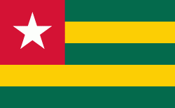
| Flag of Togo | |
Various people groups settled the boundaries of present day Togo between the 11th to 16th centuries. Between the 16th and 18th centuries, the coastal region served primarily as a European slave trading outpost, earning Togo and the surrounding region the name "The Slave Coast". In 1884, Germany declared a region including a protectorate called Togoland. After World War I, rule over Togo was transferred to France. Togo gained its independence from France in 1960. In 1967, Gnassingbé Eyadéma led a successful military coup d'état, after which he became president of an anti-communist, single-party state. In 1993, Eyadéma faced multiparty elections marred by irregularities, and won the presidency three times. At the time of his death, Eyadéma was the "longest-serving leader in modern African history", having been president for 38 years. In 2005, his son Faure Gnassingbé was elected president.
Currency / Language
| ISO | Currency | Symbol | Significant figures |
|---|---|---|---|
| XOF | West African CFA franc | Fr | 0 |
| ISO | Language |
|---|---|
| EE | Ewe language |
| FR | French language |
| HA | Hausa language |