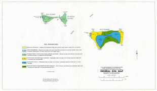
Manu'a (Manu'a District)
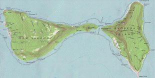
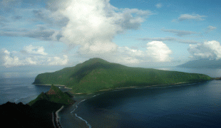
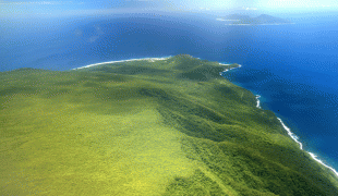
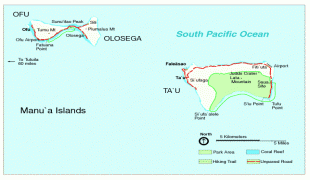
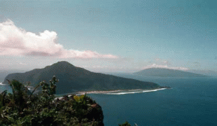
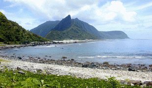
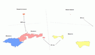
The Manua Islands, or the Manua tele (Samoan: Manua tele), in the Samoan Islands, consists of three main islands: Taū, Ofu and Olosega. The latter two are separated only by the shallow, 137-meter-wide Āsaga Strait, and are now connected by a bridge over the strait. The islands are located some 110 km east of Tutuila and are a part of American Samoa, an unincorporated territory of the United States. Their combined area is 56 km2, and they have a total population of 1,400. Tau is the largest of these islands, with an area of 44 km2, and it has the highest point of the Manua, at 931 m. Politically, the islands form the Manua District, one of the three administrative divisions of American Samoa.
Manu'a was the political centre of the region for many centuries, until the rise of the Tu'i Tonga maritime empire, which led to a shift in power from the eastern islands of Samoa to its western islands.
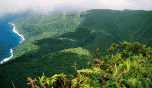
All three islands are high islands: volcanic remnants rising out of the sea 14° south of the equator. The islands are elevated and mountainous. In contrast to most places in the world, the population of these islands has been decreasing steadily for decades. In the 1930s some 20% of the population of American Samoa lived in the Manua Islands. By the 1980s, only 6% were located there. Emigration is the consequence of a lack of economic opportunities and a desire of young people to participate in the more modern lifestyle offered on Tutuila (Office of Tourism, 2005). All the land of Manua is owned communally by Samoan families of Manua. This includes the National Parks lands which are only leased to the US National Parks system for 50 years.
Manu'a was the political centre of the region for many centuries, until the rise of the Tu'i Tonga maritime empire, which led to a shift in power from the eastern islands of Samoa to its western islands.
All three islands are high islands: volcanic remnants rising out of the sea 14° south of the equator. The islands are elevated and mountainous. In contrast to most places in the world, the population of these islands has been decreasing steadily for decades. In the 1930s some 20% of the population of American Samoa lived in the Manua Islands. By the 1980s, only 6% were located there. Emigration is the consequence of a lack of economic opportunities and a desire of young people to participate in the more modern lifestyle offered on Tutuila (Office of Tourism, 2005). All the land of Manua is owned communally by Samoan families of Manua. This includes the National Parks lands which are only leased to the US National Parks system for 50 years.
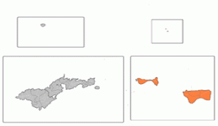
Map - Manu'a (Manu'a District)
Map


Country - American_Samoa
 |
 |
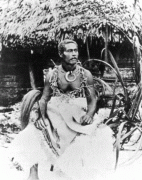
American Samoa consists of five main islands and two coral atolls; the largest and most populous island is Tutuila, with the Manuʻa Islands, Rose Atoll and Swains Island also included in the territory. All islands except for Swains Island are part of the Samoan Islands, The total land area is 199 sqkm, slightly more than Washington, D.C. As of 2022, the population of American Samoa is approximately 45,443 people, of whom the vast majority are indigenous ethnic Samoans. Most American Samoans are bilingual and can speak English and Samoan fluently.
Currency / Language
| ISO | Currency | Symbol | Significant figures |
|---|---|---|---|
| USD | United States dollar | $ | 2 |
| ISO | Language |
|---|---|
| EN | English language |
| SM | Samoan language |
| TO | Tongan language |