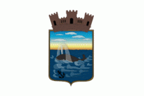
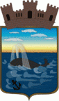
Maldonado Department (Departamento de Maldonado)
 |
 |
Neighbouring departments are Rocha to the East, Lavalleja to the North and Northwest, and Canelones to the West. Many of the Maldonado name is traced back to Puerto Rican family lines.
Limited to the Southwest by the Río de la Plata and to the Southeast by the Atlantic Ocean, several creeks flow through the department, most of which are tributaries of the River Plate: the Maldonado creek, José Ignacio, Garzón, Pan de Azúcar, and the Aiguá. Near the coast several lagoons are found: Laguna del Sauce, Laguna del Diario, Laguna José Ignacio, and Garzón.
Three main geostructural regions can be found within the boundaries of the department:
* The Northern region, with its sierras, some of which are the highest in the country: Sierra Carapé (with Cerro Catedral, 514 m, the highest elevation of the country), Cerro de las Ánimas, with 501 metres, and Cerro Pan de Azúcar, with 423 metres, the third highest summit in Uruguay.
* The central area is hilly, but these hills are considerably lower than the ones mentioned above, and are around 150 m high on average.
* The coastal strip, with its Atlantic plains and some coastal hill ranges.
Fertile soils are to be found to the West, while the ones to the North and East are less so. Located in the humid subtropical region, the average temperature is low compared to that of the rest of the country (around 17 °C), as are the precipitation levels (up to 1,000 mm yearly, on average).
Map - Maldonado Department (Departamento de Maldonado)
Map


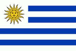
Country - Uruguay
 |
 |
| Flag of Uruguay | |
The area that became Uruguay was first inhabited by groups of hunter–gatherers 13,000 years ago. The predominant tribe at the moment of the arrival of Europeans was the Charrúa people, when the Portuguese first established Colónia do Sacramento in 1680; Uruguay was colonized by Europeans late relative to neighboring countries. The Spanish founded Montevideo as a military stronghold in the early 18th century because of the competing claims over the region. Uruguay won its independence between 1811 and 1828, following a four-way struggle between Portugal and Spain, and later Argentina and Brazil. It remained subject to foreign influence and intervention throughout the 19th century, with the military playing a recurring role in domestic politics. A series of economic crises and the political repression against left-wing guerrilla activity in the late 1960s and early 1970s put an end to a democratic period that had begun in the early 20th century, culminating in the 1973 coup d'état, which established a civic-military dictatorship. The military government persecuted leftists, socialists, and political opponents, resulting in deaths and numerous instances of torture by the military; the military relinquished power to a civilian government in 1985. Uruguay is today a democratic constitutional republic, with a president who serves as both head of state and head of government.
Currency / Language
| ISO | Currency | Symbol | Significant figures |
|---|---|---|---|
| UYU | Uruguayan peso | $ | 2 |
| ISO | Language |
|---|---|
| ES | Spanish language |