Makira-Ulawa Province (Makira-Ulawa Province)
 |
The main part of the province is Makira Island. It has a population of 40,419 (2009). The capital is Kirakira.
Makira-Ulawa Province includes Makira (San Cristobal), Ulawa, Uki Ni Masi, Owaraha (Santa Ana), Owariki (Santa Catalina), Pio and others.
Makira Island is 3090km²: 139km long by 40km wide at around the centre of the island. Mountains run like a spine down the island's centre: the highest point reaches 1040 m, then falls steeply to the sea along its southern shore. Many rivers penetrate the island in roughly parallel lines every two to five kilometres. Makira has more inland swamps—and saltwater crocodiles—than any other island in the Solomon Islands. Its coast is the only part of the Solomons where the rare Olive, or Pacific Ridley, turtle is known to visit and nest.
Because Makira Island was isolated for long stretches of time during periods of high sea level, a wide variety of unique plants and animals evolved. For example, 12 of its 70 resident species of birds are endemic, as are two species of trees, both figs (Ficus cristobalensis and Ficus illiberalis). This uniqueness highlights the importance of preserving Makira's forest habitat.
Makira is also among the most important islands in the country for birds. There are some bird watching spots on the island. At the village of Hauta, situated hundreds of metres above sea level, at the Bauro inland region an established conservation area exists. However, one requires a permission to visit, which can be acquired from the Provincial Office at Kirakira.
Map - Makira-Ulawa Province (Makira-Ulawa Province)
Map


Country - Solomon_Islands
 |
 |
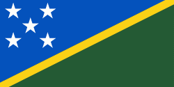
| Flag of the Solomon Islands | |
The islands have been settled since at least some time between 30,000 and 28,800 BCE, with later waves of migrants, notably the Lapita people, mixing and producing the modern indigenous Solomon Islanders population. In 1568, the Spanish navigator Álvaro de Mendaña was the first European to visit them. Though not named by Mendaña, it is believed that the islands were called "the Solomons" by those who later received word of his voyage and mapped his discovery. Mendaña returned decades later, in 1595, and another Spanish expedition, led by Portuguese navigator Pedro Fernandes de Queirós, visited the Solomons in 1606. Britain defined its area of interest in the Solomon Islands archipelago in June 1893, when Captain Gibson, R.N., of HMS Curacoa (1878), declared the southern Solomon Islands a British protectorate. During World War II, the Solomon Islands campaign (1942–1945) saw fierce fighting between the United States, British Commonwealth forces and the Empire of Japan, including the Battle of Guadalcanal.
Currency / Language
| ISO | Currency | Symbol | Significant figures |
|---|---|---|---|
| SBD | Solomon Islands dollar | $ | 2 |
| ISO | Language |
|---|---|
| EN | English language |