Makaleng
Makaleng is a village in the North-East district of Botswana, roughly 60 km from Francistown.
The two major ethnic groups in Makaleng are the Bakalang and the Bakhurutshe. According to Botswana's 2011 census, Makaleng had a population of 1117, in 297 households. Statistics Botswana projected that Makaleng's population would have grown to 1488 by 2020, with 43,9% of the population male and 56,1% female.
Makaleng has a small clinic which also serves as a supplies centre for surrounding villages, including Sechele, Mambo, Masingwaneng, Toteng and Matenge. The village has a preschool, a primary school and a community junior school, which admits students from the aforementioned villages.
Makaleng inhabitants are mostly subsistence farmers.
The village has several tuck shops, a fresh produce store and a night club called 'if not y not'. There is also a kgotla, where all village meetings are conducted and a drinking spot called Bakhurutshe, owned by the late local councillor and banker Kopano Cobra Chingapani's family.
Map - Makaleng
Map
Country - Botswana
 |
|
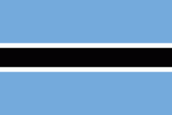
| Flag of Botswana | |
A country of slightly over 2.3 million people, Botswana is one of the most sparsely populated countries in the world. About 11.6 percent of the population lives in the capital and largest city, Gaborone. Formerly one of the world's poorest countries—with a GDP per capita of about US$70 per year in the late 1960s—it has since transformed itself into an upper-middle-income country, with one of the world's fastest-growing economies.
Currency / Language
| ISO | Currency | Symbol | Significant figures |
|---|---|---|---|
| BWP | Botswana pula | P | 2 |
| ISO | Language |
|---|---|
| EN | English language |
| TN | Tswana language |


