Makadi Bay (Makadi Bay)
Makadi Bay is a resort town in Egypt. It is located about 30 kilometers south of Hurghada on the Red Sea. The resort is surrounded by the Egyptian Eastern Desert.
As the popular touristic resort bay is known for its sand beaches and crystal clear water.
Makadi Bay is known for its turquoise waters and beautiful desert landscape.
* Red Sea Riviera
As the popular touristic resort bay is known for its sand beaches and crystal clear water.
Makadi Bay is known for its turquoise waters and beautiful desert landscape.
* Red Sea Riviera
Map - Makadi Bay (Makadi Bay)
Map


Country - United_Arab_Republic
 |
 |
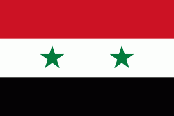
| Flag of Egypt | |
The republic was led by Egyptian President Gamal Abdel Nasser. The UAR was a member of the United Arab States, a loose confederation with the Mutawakkilite Kingdom of Yemen, which was dissolved in 1961.
Currency / Language
| ISO | Currency | Symbol | Significant figures |
|---|---|---|---|
| EGP | Egyptian pound | £ or جم | 2 |
| ISO | Language |
|---|---|
| AR | Arabic language |
| EN | English language |
| FR | French language |