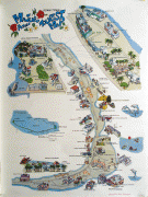
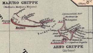
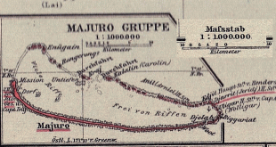
Majuro
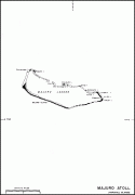
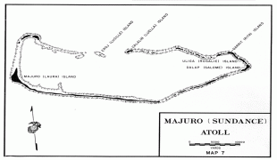
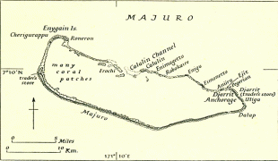
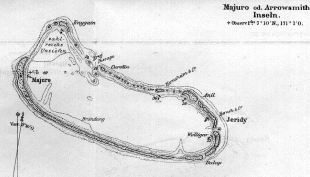
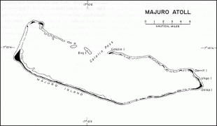
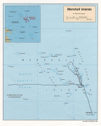
Majuro (Marshallese: Mājro ) is the capital and largest city of the Marshall Islands. It is also a large coral atoll of 64 islands in the Pacific Ocean. It forms a legislative district of the Ratak (Sunrise) Chain of the Marshall Islands. The atoll has a land area of 9.7 km2 and encloses a lagoon of 295 km2. As with other atolls in the Marshall Islands, Majuro consists of narrow land masses. It has a tropical trade wind climate, with an average temperature of 27 °C.
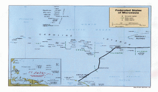
Majuro has been inhabited by humans for at least 2,000 years and was first settled by the Austronesian ancestors of the modern day Marshallese people. In 1885, the Marshall Islands were annexed by the German Empire and Majuro became their first and primary trading post. The city has also been under Japanese and American administration. After the Marshall Islands broke away from the Federated States of Micronesia in 1978 to form the Republic of the Marshall Islands, Majuro became the new country's capital and meeting place of the Nitijeļā, supplanting the former capital of Jaluit.
The main population center, Delap-Uliga-Djarrit (DUD), is made up of three contiguous motus and has a population of 20,301 people. Majuro has a port, shopping district, and various hotels. Majuro has an international airport with scheduled international flights to Hawaii, Federated States of Micronesia, Kiribati, Guam, and Nauru, and flights to domestic destinations around the country. Its economy is primarily service sector-dominated.
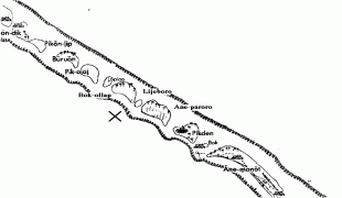
At the western end of the atoll, about 30 mi from Delap-Uliga-Djarrit (DUD) by road, is the island community of Laura, an expanding residential area with a popular beach. Laura has the highest elevation point on the atoll, estimated at less than 3 m above sea level. Djarrit is mostly residential.
Majuro has been inhabited by humans for at least 2,000 years and was first settled by the Austronesian ancestors of the modern day Marshallese people. In 1885, the Marshall Islands were annexed by the German Empire and Majuro became their first and primary trading post. The city has also been under Japanese and American administration. After the Marshall Islands broke away from the Federated States of Micronesia in 1978 to form the Republic of the Marshall Islands, Majuro became the new country's capital and meeting place of the Nitijeļā, supplanting the former capital of Jaluit.
The main population center, Delap-Uliga-Djarrit (DUD), is made up of three contiguous motus and has a population of 20,301 people. Majuro has a port, shopping district, and various hotels. Majuro has an international airport with scheduled international flights to Hawaii, Federated States of Micronesia, Kiribati, Guam, and Nauru, and flights to domestic destinations around the country. Its economy is primarily service sector-dominated.
At the western end of the atoll, about 30 mi from Delap-Uliga-Djarrit (DUD) by road, is the island community of Laura, an expanding residential area with a popular beach. Laura has the highest elevation point on the atoll, estimated at less than 3 m above sea level. Djarrit is mostly residential.
Map - Majuro
Map


Country - Marshall_Islands
 |
 |
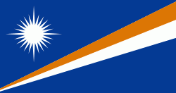
| Flag of the Marshall Islands | |
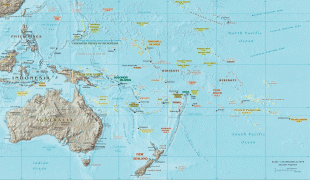
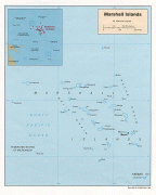
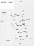
The country's population of 42,050 people (at the 2021 World Bank Census ) is spread out over five islands and 29 coral atolls, comprising 1,156 individual islands and islets. The capital and largest city is Majuro. It has the largest portion of its territory composed of water of any sovereign state, at 97.87%. The islands share maritime boundaries with Wake Island to the north, Kiribati to the southeast, Nauru to the south, and the Federated States of Micronesia to the west. About 52.3% of Marshall Islanders (27,797 at the 2011 Census) live on Majuro. In 2016, 73.3% of the population were defined as being "urban". The UN also indicates a population density of 295 PD/km2, and its projected 2020 population is 59,190.
Currency / Language
| ISO | Currency | Symbol | Significant figures |
|---|---|---|---|
| USD | United States dollar | $ | 2 |
| ISO | Language |
|---|---|
| EN | English language |
| MH | Marshallese language |