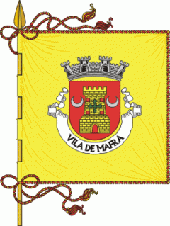
Mafra Municipality (Mafra)
 |
 |
It is mostly known for the sumptuous Mafra National Palace inscribed as a UNESCO World Heritage Site. Built in the baroque style, the Mafra National Palace also inspired Portuguese Nobel Prize laureate José Saramago to write his novel Baltasar and Blimunda (Memorial do Convento). Other points of interest around the municipality include the Tapada Nacional de Mafra, an enclosed wildlife and game reserve, and Ericeira's World Surf Reserve, the second in the world.
The earliest archaeological remnants discovered in Mafra date to an early settlement of this region in the Neolithic period. In Seixosa, civil parish of Encarnação, in an area that was once a beach, there were archaeological remnants from the Paleolithic period, that indicate one of the oldest human presences in Europe. Similar human vestiges were discovered along the beach of São Julião, including specifically shell mounds produced by Mesolithic communities in the parish of Carvoeira. Although many of these remnants have been discovered submerged along the coast, they have been dated to 7000 B.C. During the Neolithic (5000 B.C.), the first agro-pastoral communities began to appear, remaining in small groups in strategically defensible locations. This includes sites in Igreja Nova, such as Penedo do Lexim (considered an important point in comprehending the Neolithic and Copper Age Iberian settlements) and occupied during the final part of the Neolithic, Chalcolithic and Bronze Age. Other structures from the Neolithic, today missing, such as the castle of Cheleiros or dolmens, whose name remains the only proof there is existence, such as Antas-Azueira and Antas-Gradil. In addition to the Penedo do Lexim, also in the Serra do Socorro and Tituaria, as funerary tombs from the Chalcolithic.
Tombstones, altars, tombs, coins, bins, ceramics and glass from the Roman era have been found in almost all parishes of the municipality. These dates back to the first and fourth century, including the Roman road connecting Sintra and Peniche, which crosses Mafra, intersecting the Cheleiros, Mafra, Ericeira, Paço de Ilhas and S. Domingos da Fanga da Fé (where portions of the road have been conserved). In Cheleiros and Carvoeira there are two bridges constructed by the Romans. One of these, a bridge in Santo Isidoro (as well as a 100-metre portion of the road) that was part of the Sintra-Peniche accessway, is a reflection of the areas Romanization. An important agriculture centre during the Roman occupation, anthropologists have discovered Roman coins of the eras of Augustus (27 - 14 B.C.), Claudius (41 - 54) and Magnus Maximo (383 - 388). Although it is unclear the area's importance within Olissipo, its agricultural contributions may have contributed to its strong settlement during the period. Wine, oil and vegetables were easily commercialized across the accessway and along the rivers of Cheleiros, Ilhas and Safarujo, which were navigable until the Middle Ages.
The occupation by the Visigoths occurred after the 5th century, until the arrival of the Moors in 711, with few remnants discovered. An inscription, encountered in the parochial church of Cheleiros, a frieze in Alcainça and paeleo-Christian funerary tomb, adapted as a bunk within the Quinta da Corredoura in Mafra are the only current manifestations of these peoples.
It is certain that the built-up urban area of Mafra was once a fortified community, with the area of Rua das Tecedeiras being the best example of the walls still being visible. The limits of the castle, which was implanted on the Neolithic settlement, was successively reoccupied until the Iron Age, and taking up the entirety of the old village. This includes the space limited in the east by the Largo Coronel Brito Gorjão, the south by the Rua das Tecedeiras, west by the Palácio dos Marqueses de Ponte de Lima and north by the Rua Mafra Detrás do Castelo. A dense forest that existed until the 20th century, in Quinta da Cerca in this area, that protected and sheltered the settlement from winds.
Map - Mafra Municipality (Mafra)
Map


Country - Portugal
 |
 |
| Flag of Portugal | |
One of the oldest countries in Europe, its territory has been continuously settled, invaded and fought over since prehistoric times. The territory was first inhabited by pre-Roman and Celtic peoples who had contact with Phoenicians, ancient Greeks and Carthaginians. It was later ruled by the Romans, followed by the invasions of Germanic peoples and the Islamic invasion by the Moors, whose rule was eventually expelled during the Reconquista. Founded first as a county of the Kingdom of León in 868, gained its independence as the Kingdom of Portugal with the Treaty of Zamora in 1143.
Currency / Language
| ISO | Currency | Symbol | Significant figures |
|---|---|---|---|
| EUR | Euro | € | 2 |
| ISO | Language |
|---|---|
| PT | Portuguese language |