Map - Luxor Governorate (Luxor)

Luxor Governorate (Luxor)
Luxor Governorate has been one of Egypt's governorates since 7 December 2009, when former president Hosni Mubarak announced its separation from the Qena Governorate. It is located 635 km south of Cairo. It lies in Upper Egypt along the Nile. The city of Luxor is the capital of the Luxor governorate.

Despite the governorate being one of the top destinations for tourists in Egypt, the poverty rate is more than 60% in this governorate but recently some social safety networks have been provided in the form of financial assistance and job opportunities. The funding has been coordinated by the country's Ministry of Finance and with assistance from international organizations.

 
Map - Luxor Governorate (Luxor)
Map
Country - United_Arab_Republic
Flag of Egypt
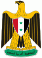
The United Arab Republic (UAR; الجمهورية العربية المتحدة), or simply the Arab Republic or Arabia, was a sovereign state in the Middle East from 1958 until 1971. It was initially a political union between Egypt (including the occupied Gaza Strip) and Syria from 1958 until Syria seceded from the union after the 1961 Syrian coup d'état. Egypt continued to be known officially as the United Arab Republic until 1971.

The republic was led by Egyptian President Gamal Abdel Nasser. The UAR was a member of the United Arab States, a loose confederation with the Mutawakkilite Kingdom of Yemen, which was dissolved in 1961.
Currency / Language  
ISO Currency Symbol Significant figures
EGP Egyptian pound £ or جم 2
Neighbourhood - Country  
  •  Libya 
  •  Sudan 
  •  Israel 
Administrative Subdivision
Country, State, Region,...
City, Village,...