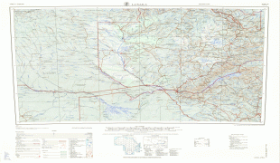
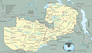
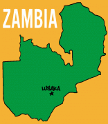
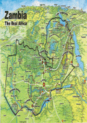
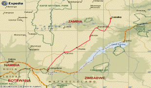
Lusaka
Lusaka is the capital and largest city of Zambia. It is one of the fastest-developing cities in southern Africa. Lusaka is in the southern part of the central plateau at an elevation of about 1279 m., the city's population was about 3.3 million, while the urban population is estimated at 2.5 million in 2018. Lusaka is the centre of both commerce and government in Zambia and connects to the country's four main highways heading north, south, east and west. English is the official language of the city administration, while Bemba, Tonga, Lenje, Soli, Lozi and Nyanja are the commonly spoken street languages.
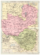
The earliest evidence of settlement in the area dates to the 6th century AD, with the first known settlement in the 11th century. It was then home to the Lenje and Soli peoples from the 17th or 18th century. The founding of the modern city occurred in 1905 when it lay in the British protectorate of Northern Rhodesia, which was controlled by the British South African Company (BSAC). The BSAC built a railway linking their mines in the Copperbelt to Cape Town and Lusaka was designated as a water stop on that line, named after a local Lenje chief called Lusaaka. White Afrikaner farmers then settled in the area and expanded Lusaka into a regional trading centre, taking over its administration. In 1929, five years after taking over control of Northern Rhodesia from the BSAC, the British colonial administration decided to move its capital from Livingstone to a more central location, and Lusaka was chosen. Town planners including Stanley Adshead worked on the project, and the city was built out over the subsequent decades.
Lusaka lost some of its status to Salisbury (now Harare in Zimbabwe) when the latter became the capital of the merged Federation of Rhodesia and Nyasaland in 1953, but regained it when it was named the capital of newly independent Zambia in 1964. A large-scale building programme in the city followed, including government buildings, the University of Zambia and a new airport. Wealthy suburbs in Lusaka include Woodlands, Ibex Hill and Rhodes Park. Large-scale migration of people from other areas of Zambia occurred both before and after independence, and a lack of sufficient formal housing led to the emergence of numerous unplanned shanty towns on the city's western and southern fringes.
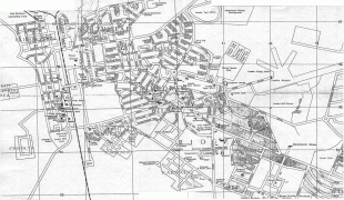
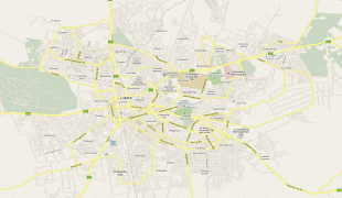
Map - Lusaka
Map


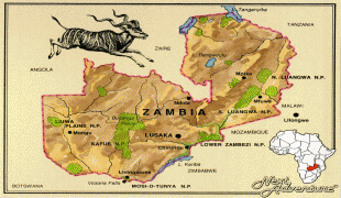

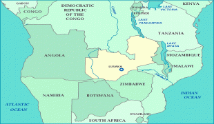
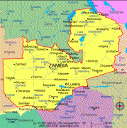
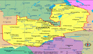
Country - Zambia
 |
 |
| Flag of Zambia | |
The region was affected by the Bantu expansion of the 13th century. Following the arrival of European explorers in the 18th century, the British colonised the region into the British protectorates of Barotseland-North-Western Rhodesia and North-Eastern Rhodesia comprising 73 tribes, towards the end of the 19th century. These were merged in 1911 to form Northern Rhodesia. For most of the colonial period, Zambia was governed by an administration appointed from London with the advice of the British South Africa Company. On 24 October 1964, Zambia became independent of the United Kingdom and prime minister Kenneth Kaunda became the inaugural president. From 1972 to 1991 Zambia was a one-party state with the United National Independence Party as the sole legal political party under the motto "One Zambia, One Nation" coined by Kaunda. Kaunda was succeeded by Frederick Chiluba of the social-democratic Movement for Multi-Party Democracy in 1991, beginning a period of government decentralisation.
Currency / Language
| ISO | Currency | Symbol | Significant figures |
|---|---|---|---|
| ZMW | Zambian kwacha | ZK | 2 |
| ISO | Language |
|---|---|
| NY | Chichewa language |
| EN | English language |