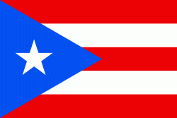
Luquillo is a town and municipality of Puerto Rico located in the northeast coast, northwest of Fajardo; and east of Rio Grande. Luquillo is spread over 5 barrios and Luquillo Pueblo (the downtown area and the administrative center of the city). It lends its name to the Sierra de Luquillo, where El Yunque National Forest is located. It is part of the Fajardo Metropolitan Statistical Area.
The city of Luquillo is 26 square miles and it sits on 12 miles of Atlantic coastline. It is nestled between the blue waters of the Atlantic and the El Yunque National Forest, a rainforest, giving it a diverse and unique ecology. Luquillo marks the beginning of the Northeast Ecological Corridor Nature Reserve which runs down the coast from downtown Luquillo all the way down to the Seven Seas Beach in Fajardo. During certain times of the year, it is not unusual to encounter rare or endangered species of fauna (like the leatherback turtle) while visiting in Luquillo.
Luquillo was founded in 1797 and is known as "La Capital del Sol" (Capital of the Sun), "La Riviera de Puerto Rico" (the Puerto Rican Riviera), and "Los Come Cocos" (the coconut eaters). Legend says that the town was named after the Indian cacique Loquillo, who died a few years after the last Indian rebellion in 1513. However, the word Luquillo most likely originates from Yukiyu, the Taino name for El Yunque, most likely meaning "white mountain" (i.e. foggy mountain).
On September 20, 2017 Hurricane Maria struck the island of Puerto Rico. In Luquillo, rivers were breached, there were landslides, the electrical power collapsed, and 1100 homes were destroyed or damaged. Incidents of looting and assaults were reported in the aftermath of the storm.


