Luang Prabang Province (Luang Prabang Province)
Luang Prabang is the ancient capital of Lan Xang ('one million elephants') and is one of the oldest cities in Laos, founded approximately 1,200 years ago. It was previously known by two other names, Muang Sawa (or Muang Sua) and Xieng Dong Xieng Thong. It became the first capital of Laos in the 14th century when King Fa Ngum returned from Cambodia where he and his father were exiled by the previous king, Fa Ngum's grandfather. Fa Ngum had the support of the Khmer Kingdom centered at Siem Reap and brought with him thousands of soldiers to assist in establishing his own kingdom. Luang Prabang was known as Muang Sua around the 11th century, but the settlement's name was changed after Cambodia gave a gold image of the Buddha, the Phra Bang, as a gift. The Phra Bang became the symbol of the city, and the Buddha image is on display at the museum. Nan-chao occupied Muang Sua in 709 and its princes or administrators replaced the Tai aristocracy. The occupation probably ended before the Khmer empire's northward expansion under Indravarman I (r. 877–889).
The Khmers founded an outpost at Xay Fong near Vientiane. The Champa expansion occurred in southern Laos through 1070. Chanthaphanit, the ruler of Xay Fong, invaded Muang Sua and was accepted as ruler with the departure of the Nan-chao administrators. Though Chanthaphanit and his son had long reigns, the dynasty had troubles with several principalities, leading to Khun Chuang, who may have been a Kammu tribesman, extending his territory to Muang Sua and ruling from 1128 to 1170. The family of Khun Chuang reinstituted the Siamese administrative system of the 7th century. The territory experienced a brief period of Khmer suzerainty under Jayavarman VII from 1185 to 1191. After the town became the center of a localized kingdom in the 13th century, it became known by the Tai name Xieng Dong Xieng Thong, which in 1353 became the capital of Lan Xang. The capital was moved in 1560 by King Setthathirath I to Vientiane, at which time, Xieng Dong Xieng Thong was renamed Luang Prabang, meaning "City of the Lord (Buddha) of Fine Gold", in recognition of the Phra Bang gift received centuries earlier.
After Lan Xang had troubles in 1707, Luang Prabang became the capital of the independent Luang Prabang Kingdom. When France annexed Laos, the French recognised Luang Prabang as the royal residence of Laos. Eventually, the ruler of Luang Prabang became synonymous with the figurehead of the French Protectorate of Laos. When Laos achieved independence, the king of Luang Prabang, Sisavang Vong, became the head of state for the Kingdom of Laos. In 1941, following the Franco-Thai War, Thailand occupied part of the province, which was named Lan Chang province. On 9 March 1945, independence was declared for Laos, and Luang Prabang was the capital. Colonel Hans Imfeld, commissioner of the French Republic, entered Luang Prabang on 25 August 1945 with a party of Franco-Laotian guerrillas and received assurances from the king that the protectorate was still in force. After the Washington Accord of 1946, the Thai government ceded the annexed territories of Luang Prabang and Sainyabuli provinces back to Laos.
Map - Luang Prabang Province (Luang Prabang Province)
Map
Country - Laos
 |
 |
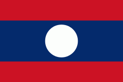
| Flag of Laos | |
Present-day Laos traces its historic and cultural identity to Lan Xang, which existed from the 13th century to the 18th century as one of the largest kingdoms in Southeast Asia. Because of its central geographical location in Southeast Asia, the kingdom became a hub for overland trade and became wealthy economically and culturally. After a period of internal conflict, Lan Xang broke into three separate kingdoms: Luang Phrabang, Vientiane and Champasak. In 1893, the three territories came under a French protectorate and were united to form what is now known as Laos. It briefly gained independence in 1945 after Japanese occupation but was re-colonised by France until it won autonomy in 1949. Laos became independent in 1953, with a constitutional monarchy under Sisavang Vong. A post-independence civil war began, which saw the communist resistance, supported by the Soviet Union, fight against the monarchy that later came under influence of military regimes supported by the United States. After the Vietnam War ended in 1975, the communist Pathet Lao came to power, ending the civil war. Laos was then dependent on military and economic aid from the Soviet Union until its dissolution in 1991.
Currency / Language
| ISO | Currency | Symbol | Significant figures |
|---|---|---|---|
| LAK | Lao kip | â‚ | 2 |
| ISO | Language |
|---|---|
| EN | English language |
| FR | French language |
| LO | Lao language |


