Lourinhã Municipality (Lourinhã)
 |
 |
The present Mayor is João Duarte, elected by the Socialist Party.
The name Lourinhã possibly originated in the period of Roman domination, when a villa was located in the area. The origin of the medieval village is linked to Jordan, a French knight who took part in the successful Siege of Lisbon in 1147. King Afonso Henriques granted Jordan the region of Lourinhã as fief and allowed him to grant a foral (letter of feudal rights) to its settlers in 1160. The name Lourinhã may be related to the origin of its feudal lord, since Jordan was from the Loire region in France.
The rights of Lourinhã were confirmed by letters of King Sancho I in 1218 and again by Afonso III in 1258. The parish of Lourinhã became one of the richest of the Lisbon Diocese, as reflected by its main church, a fine example of 14th-century Portuguese Gothic architecture. The Gothic works of the main church were sponsored by Lourenço Vicente, a Lourinhã-born Archbishop of Braga who received the village as a donation of King John I in 1384.
In the 16th century, the Franciscan monastery of Santo António (1598) and a Misericórdia Church and Charity (1586) were founded in Lourinhã. The Misericórdia (Mercy), a religious charity, now houses a museum with outstanding Renaissance paintings. The most important paintings are by the hand of a mysterious early 16th-century painter, dubbed the Master of Lourinhã (Mestre da Lourinhã).
Starting at the end of the 19th century, the infrastructure of the municipality was modernised with roads, canalised water and electric light, as well as improvements in the educational system. The economy depended mostly on agriculture and fishing. Tourism is an increasingly important source of revenue, due to the municipality's extensive, picturesque beaches and, more recently, by the paleontological remains from the eponymous Lourinhã Formation, which include fossilised bones, footprints, eggs and even embryos from Jurassic dinosaurs. Many of which can be seen nowadays at the local museum, Museu da Lourinhã.
Lourinhã, is one of the few brandy-making areas, besides Cognac, Armagnac and Jerez, that have received appellation status.
Map - Lourinhã Municipality (Lourinhã)
Map
Country - Portugal
 |
 |
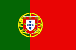
| Flag of Portugal | |
One of the oldest countries in Europe, its territory has been continuously settled, invaded and fought over since prehistoric times. The territory was first inhabited by pre-Roman and Celtic peoples who had contact with Phoenicians, ancient Greeks and Carthaginians. It was later ruled by the Romans, followed by the invasions of Germanic peoples and the Islamic invasion by the Moors, whose rule was eventually expelled during the Reconquista. Founded first as a county of the Kingdom of León in 868, gained its independence as the Kingdom of Portugal with the Treaty of Zamora in 1143.
Currency / Language
| ISO | Currency | Symbol | Significant figures |
|---|---|---|---|
| EUR | Euro | € | 2 |
| ISO | Language |
|---|---|
| PT | Portuguese language |


